
USGS Topographic Maps
The University of Connecticut Library Map and Geographic Information Center - MAGIC collections include a series of Connecticut digitized topographic maps. The United States Geological Survey (USGS) topoView website includes all of these maps plus historic to current topographic maps for the entire United States. This site provides the ability to search by location to locate USGS topographic maps at multiple scales and for multiple years for each location in the United States and provides the option to download each topographic map in GeoTIFF format.
USGS Historical Topographic Maps
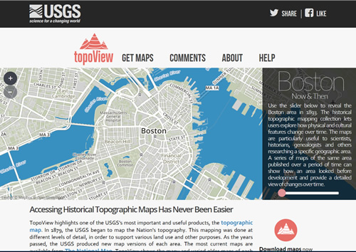
The USGS also offers a national index of digitized historical topographic maps called topoView which allows you to search by location for historical topographic maps and to download the maps in JPEG, KMZ, GeoPDF, and GeoTIFF format. While these maps may not be as printer-friendly as the PDF Quads from National Geographic, the topoView interface provides nationwide access to historical topographic maps at a range of scales. A brief overview of the topoView interface is available on the Outside the Neatline blog.
Connecticut USGS Topographic Maps from MAGIC's collections by Quadrangle
The following links include USGS topographic maps from MAGIC's collections along with the ability to view and download each map in JPEG or full quality TIFF formats. The TIFF images include the GeoTIFF file format for those that prefer a georeferenced version of the topographic map for use in GIS software programs.
Connecticut USGS Topographic Map Quadrangles Amenia - Coventry
This collection includes 72 topographic quadrangle maps with scales ranging from 1:62,500 to 1:24,000.
Connecticut USGS Topographic Map Quadrangles Danbury - Hartford South
This collection includes 100 topographic quadrangle maps with scales ranging from 1:125,000 to 1:24,000.
Connecticut USGS Topographic Map Quadrangles Jewett City - Norwich
This collection includes 154 topographic quadrangle maps with scales ranging from 1:125,000 to 1:24,000.
Connecticut USGS Topographic Map Quadrangles Old Lyme - Stonington
This collection includes 155 topographic quadrangle maps with scales ranging from 1:125,000 to 1:24,000.
Connecticut USGS Topographic Map Quadrangles Tariffville - Woodstock
This collection includes 123 topographic quadrangle maps with scales ranging from 1:62,500 to 1:24,000.
More USGS Topographic Maps options are coming soon including shapefile indexes and KML layers which include links to all of these topographic maps!