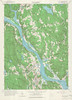
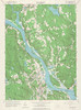
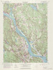
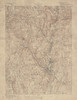
The following listing includes USGS topographic maps from MAGIC's collections along with the ability to view and download each map in JPEG or full quality TIFF formats. The TIFF images include the GeoTIFF file format for those that need a georeferenced version of the topographic map for use in GIS software programs.
Title |
Quadrangle |
Year |
Scale |
Source |
Metadata |
Series # |
Download Georeferenced TIFF
|
Preview & Download JPEG |
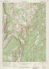
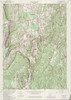
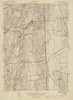
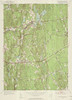
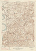
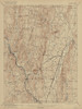
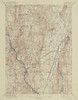
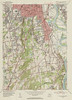
| Danbury Sheet 1889 - USGS Topographic 1:62,500 |
DANBURY |
1889 |
1:62,500 |
USGS |
Coming Soon |
1 |
 |
 |
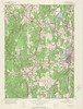
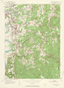
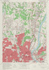
| Danbury Quadrangle 1953 - USGS Topographic 1:24,000 |
DANBURY |
1953 |
1:24,000 |
USGS |
Coming Soon |
1 |
|
 |
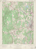
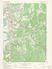
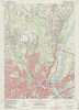
| Danbury Quadrangle 1963 - USGS Topographic 1:24,000 |
DANBURY |
1963 |
1:24,000 |
USGS |
Coming Soon |
1 |
|
 |
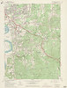
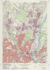
| Danbury Quadrangle 1972 - USGS Topographic 1:24,000 |
DANBURY |
1972 |
1:24000 |
USGS |
Coming Soon |
1 |
|
 |
| Danbury Quadrangle 1984 - USGS Topographic 1:24,000 |
DANBURY |
1984 |
1:24,000 |
USGS |
Coming Soon |
1 |
|
 |
| Danielson Quadrangle 1946 - USGS Topographic 1:31,680 |
DANIELSON |
1946 |
1:31,680 |
USGS |
Coming Soon |
1 |
|
 |
| Danielson Quadrangle 1955 - USGS Topographic 1:24,000 |
DANIELSON |
1955 |
1:24,000 |
USGS |
Coming Soon |
1 |
|
 |
| Danielson Quadrangle 1970 - USGS Topographic 1:24,000 |
DANIELSON |
1970 |
1:24,000 |
USGS |
Coming Soon |
1 |
|
 |
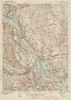
| Deep River Quadrangle 1944 - USGS Topographic 1:31,680 |
DEEP RIVER |
1944 |
1:31,680 |
USGS |
Coming Soon |
1 |
|
 |
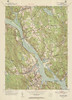
| Deep River Quadrangle 1952 - USGS Topographic 1:31,680 |
DEEP RIVER |
1952 |
1:31,680 |
USGS |
Coming Soon |
1 |
|
 |
| Deep River Quadrangle 1961 - USGS Topographic 1:24,000 |
DEEP RIVER |
1961 |
1:24,000 |
USGS |
Coming Soon |
1 |
|
 |
| Deep River Quadrangle 1970 - USGS Topographic 1:24,000 |
DEEP RIVER |
1970 |
1:24,000 |
USGS |
Coming Soon |
1 |
|
 |
| Deep River Quadrangle 1971 - USGS Topographic 1:24,000 |
DEEP RIVER |
1971 |
1:24,000 |
USGS |
Coming Soon |
1 |
|
 |
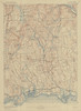
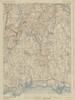
| Derby Sheet 1893 - USGS Topographic 1:62,500 |
DERBY |
1893 |
1:62,500 |
USGS |
Coming Soon |
1 |
|
 |
| Derby Sheet 1912 - USGS Topographic 1:62,500 |
DERBY |
1912 |
1:62,500 |
USGS |
Coming Soon |
1 |
|
 |
| Derby Sheet 1942 - USGS Topographic 1:62,500 |
DERBY |
1942 |
1:62,500 |
USGS |
Coming Soon |
1 |
|
 |
| Dover Plains Quadrangle 1947 - USGS Topographic 1:31,680 |
DOVER PLAINS |
1947 |
1:31,680 |
USGS |
Coming Soon |
1 |
|
 |
| Dover Plains Quadrangle 1958 - USGS Topographic 1:24,000 |
DOVER PLAINS |
1958 |
1:24,000 |
USGS |
Coming Soon |
1 |
|
 |
| Dover Plains Quadrangle 1971 - USGS Topographic 1:24,000 |
DOVER PLAINS |
1971 |
1:24,000 |
USGS |
Coming Soon |
1 |
|
 |
| Dover Plains Quadrangle 1976 - USGS Topographic 1:24,000 |
DOVER PLAINS |
1976 |
1:24,000 |
USGS |
Coming Soon |
1 |
|
 |
| Dover Plains Quadrangle 1984 - USGS Topographic 1:24,000 |
DOVER PLAINS |
1984 |
1:24,000 |
USGS |
Coming Soon |
1 |
|
 |
| Dover Plains Quadrangle 1998 - USGS Topographic 1:24,000 |
DOVER PLAINS |
1998 |
1:24,000 |
USGS |
Coming Soon |
1 |
|
 |
| Durham Quadrangle 1953 - USGS Topographic 1:24,000 |
DURHAM |
1953 |
1:24,000 |
USGS |
Coming Soon |
1 |
|
 |
| Durham Quadrangle 1964 - USGS Topographic 1:24,000 |
DURHAM |
1964 |
1:24,000 |
USGS |
Coming Soon |
1 |
|
 |
| Durham Quadrangle 1972 - USGS Topographic 1:24,000 |
DURHAM |
1972 |
1:24,000 |
USGS |
Coming Soon |
1 |
|
 |
| Durham Quadrangle 1984 - USGS Topographic 1:24,000 |
DURHAM |
1984 |
1:24,000 |
USGS |
Coming Soon |
1 |
|
 |
| East Killingly Quadrangle 1945 - USGS Topographic 1:31,680 |
EAST KILLINGLY |
1945 |
1:31,680 |
USGS |
Coming Soon |
1 |
|
 |
| East Killingly Quadrangle 1955 - USGS Topographic 1:24,000 |
EAST KILLINGLY |
1955 |
1:24,000 |
USGS |
Coming Soon |
1 |
|
 |
| East Killingly Quadrangle 1970 - USGS Topographic 1:24,000 |
EAST KILLINGLY |
1970 |
1:24,000 |
USGS |
Coming Soon |
1 |
|
 |
| East Killingly Quadrangle 1974 - USGS Topographic 1:24,000 |
EAST KILLINGLY |
1974 |
1:24,000 |
USGS |
Coming Soon |
1 |
|
 |
| Eastford Quadrangle 1945 - USGS Topographic 1:31,680 |
EASTFORD |
1945 |
1:31,680 |
USGS |
Coming Soon |
1 |
|
 |
| Eastford Quadrangle 1953 - USGS Topographic 1:24,000 |
EASTFORD |
1953 |
1:24,000 |
USGS |
Coming Soon |
1 |
|
 |
| Eastford Quadrangle 1970 - USGS Topographic 1:24,000 |
EASTFORD |
1970 |
1:24,000 |
USGS |
Coming Soon |
1 |
|
 |
| Eastford Quadrangle 1983 - USGS Topographic 1:24,000 |
EASTFORD |
1983 |
1:24,000 |
USGS |
Coming Soon |
1 |
|
 |
| Ellington Quadrangle 1946 - USGS Topographic 1:31,680 |
ELLINGTON |
1946 |
1:31,680 |
USGS |
Coming Soon |
1 |
|
 |
| Ellington Quadrangle 1953 - USGS Topographic 1:24,000 |
ELLINGTON |
1953 |
1:24,000 |
USGS |
Coming Soon |
1 |
|
 |
| Ellington Quadrangle 1967 - USGS Topographic 1:24,000 |
ELLINGTON |
1967 |
1:24,000 |
USGS |
Coming Soon |
1 |
|
 |
| Ellington Quadrangle 1972 - USGS Topographic 1:24,000 |
ELLINGTON |
1972 |
1:24,000 |
USGS |
Coming Soon |
1 |
|
 |
| Ellington Quadrangle 1984 - USGS Topographic 1:24,000 |
ELLINGTON |
1984 |
1:24,000 |
USGS |
Coming Soon |
1 |
|
 |
| Ellsworth Quadrangle 1950 - USGS Topographic 1:31,680 |
ELLSWORTH |
1950 |
1:31,680 |
USGS |
Coming Soon |
1 |
|
 |
| Ellsworth Quadrangle 1956 - USGS Topographic 1:24,000 |
ELLSWORTH |
1956 |
1:24,000 |
USGS |
Coming Soon |
1 |
|
 |
| Ellsworth Quadrangle 1969 - USGS Topographic 1:24,000 |
ELLSWORTH |
1969 |
1:24,000 |
USGS |
Coming Soon |
1 |
|
 |
| Essex Quadrangle 1944 - USGS Topographic 1:31,680 |
ESSEX |
1944 |
1:31,680 |
USGS |
Coming Soon |
1 |
|
 |
| Essex Quadrangle 1958 - USGS Topographic 1:24,000 |
ESSEX |
1958 |
1:24,000 |
USGS |
Coming Soon |
1 |
|
 |
| Essex Quadrangle 1970 - USGS Topographic 1:24,000 |
ESSEX |
1970 |
1:24,000 |
USGS |
Coming Soon |
1 |
|
 |
| Essex Quadrangle 1977 - USGS Topographic 1:24,000 |
ESSEX |
1977 |
1:24,000 |
USGS |
Coming Soon |
1 |
|
 |
| Farmington Quadrangle 1906 - USGS Topographic 1:125,000 |
FARMINGTON |
1906 |
1:125,000 |
USGS |
Coming Soon |
1 |
|
 |
| Farmington Quadrangle 1942 - USGS Topographic 1:125,000 |
FARMINGTON |
1942 |
1:125,000 |
USGS |
Coming Soon |
1 |
|
 |
| Fitchville Quadrangle 1943 - USGS Topographic Map 1:31,680 |
FITCHVILLE |
1943 |
1:31,680 |
USGS |
Coming Soon |
1 |
|
 |
| Fitchville Quadrangle 1953 - USGS Topographic Map 1:24,000 |
FITCHVILLE |
1953 |
1:24,000 |
USGS |
Coming Soon |
1 |
|
 |
| Fitchville Quadrangle 1970 - USGS Topographic Map 1:24,000 |
FITCHVILLE |
1970 |
1:24,000 |
USGS |
Coming Soon |
1 |
|
 |
| Fitchville Quadrangle 1983 - USGS Topographic Map 1:24,000 |
FITCHVILLE |
1983 |
1:24,000 |
USGS |
Coming Soon |
1 |
|
 |
| Gilead Sheet 1912 - USGS Topographic 1:62,500 |
GILEAD |
1912 |
1:62,500 |
USGS |
Coming Soon |
1 |
|
 |
| Gilead Sheet 1922 - USGS Topographic 1:62,500 |
GILEAD |
1922 |
1:62,500 |
USGS |
Coming Soon |
1 |
|
 |
| Gilead Sheet 1942 - USGS Topographic 1:62,500 |
GILEAD |
1946 |
1:62,500 |
USGS |
Coming Soon |
1 |
|
 |
| Glastonbury Quadrangle 1946 - USGS Topographic Map 1:31,680 |
GLASTONBURY |
1946 |
1:31,680 |
USGS |
Coming Soon |
1 |
|
 |
| Glastonbury Quadrangle 1953 - USGS Topographic Map 1:24,000 |
GLASTONBURY |
1953 |
1:24,000 |
USGS |
Coming Soon |
1 |
|
 |
| Glastonbury Quadrangle 1964 - USGS Topographic Map 1:24,000 |
GLASTONBURY |
1964 |
1:24,000 |
USGS |
Coming Soon |
1 |
|
 |
| Glastonbury Quadrangle 1972 - USGS Topographic Map 1:24,000 |
GLASTONBURY |
1972 |
1:24,000 |
USGS |
Coming Soon |
1 |
|
 |
| Glastonbury Quadrangle 1984 - USGS Topographic Map 1:24,000 |
GLASTONBURY |
1984 |
1:24,000 |
USGS |
Coming Soon |
1 |
|
 |
| Glenville Quadrangle 1947 - USGS Topographic 1:24,000 |
GLENVILLE |
1947 |
1:24,000 |
USGS |
Coming Soon |
1 |
|
 |
| Glenville Quadrangle 1951 - USGS Topographic 1:24,000 |
GLENVILLE |
1951 |
1:24,000 |
USGS |
Coming Soon |
1 |
|
 |
| Glenville Quadrangle 1960 - USGS Topographic 1:24,000 |
GLENVILLE |
1960 |
1:24,000 |
USGS |
Coming Soon |
1 |
|
 |
| Glenville Quadrangle 1971 - USGS Topographic 1:24,000 |
GLENVILLE |
1971 |
1:24,000 |
USGS |
Coming Soon |
1 |
|
 |
| Granby Sheet 1910 - USGS Topographic Map 1:62,500 |
GRANBY |
1910 |
1:62,500 |
USGS |
Coming Soon |
1 |
|
 |
| Granby Sheet 1917 - USGS Topographic Map 1:62,500 |
GRANBY |
1917 |
1:62,500 |
USGS |
Coming Soon |
1 |
|
 |
| Granby Sheet 1939 - USGS Topographic Map 1:62,500 |
GRANBY |
1939 |
1:62,500 |
USGS |
Coming Soon |
1 |
|
 |
| Guilford Sheet 1909 - USGS Topographic 1:62,500 |
GUILFORD |
1909 |
1:62,500 |
USGS |
Coming Soon |
1 |
|
 |
| Guilford Sheet 1936 - USGS Topographic 1:62,500 |
GUILFORD |
1936 |
1:62,500 |
USGS |
Coming Soon |
1 |
|
 |
| Guilford Sheet 1944 - USGS Topographic 1:62,500 |
GUILFORD |
1944 |
1:62,500 |
USGS |
Coming Soon |
1 |
|
 |
| Guilford Quadrangle 1954 - USGS Topographic 1:24,000 |
GUILFORD |
1954 |
1:24,000 |
USGS |
Coming Soon |
1 |
|
 |
| Guilford Quadrangle 1968 - USGS Topographic 1:24,000 |
GUILFORD |
1968 |
1:24,000 |
USGS |
Coming Soon |
1 |
|
 |
| Guilford Quadrangle 1972 - USGS Topographic 1:24,000 |
GUILFORD |
1972 |
1:24,000 |
USGS |
Coming Soon |
1 |
|
 |
| Haddam Quadrangle 1952 - USGS Topographic 1:31,680 |
HADDAM |
1952 |
1:31,680 |
USGS |
Coming Soon |
1 |
|
 |
| Haddam Quadrangle 1961 - USGS Topographic 1:24,000 |
HADDAM |
1961 |
1:24,000 |
USGS |
Coming Soon |
1 |
|
 |
| Haddam Quadrangle 1971 - USGS Topographic 1:24,000 |
HADDAM |
1971 |
1:24,000 |
USGS |
Coming Soon |
1 |
|
 |
| Hamburg Quadrangle 1952 - USGS Topographic 1:24,000 |
HAMBURG |
1952 |
1:24,000 |
USGS |
Coming Soon |
1 |
|
 |
| Hamburg Quadrangle 1961 - USGS Topographic 1:24,000 |
HAMBURG |
1961 |
1:24,000 |
USGS |
Coming Soon |
1 |
|
 |
| Hamburg Quadrangle 1971 - USGS Topographic 1:24,000 |
HAMBURG |
1971 |
1:24,000 |
USGS |
Coming Soon |
1 |
|
 |
| Hamburg Quadrangle 1984 - USGS Topographic 1:24,000 |
HAMBURG |
1984 |
1:24,000 |
USGS |
Coming Soon |
1 |
|
 |
| Hampden Quadrangle 1946 - USGS Topographic 1:24,000 |
HAMPDEN |
1946 |
1:24,000 |
USGS |
Coming Soon |
1 |
|
 |
| Hampden Quadrangle 1958 - USGS Topographic 1:24,000 |
HAMPDEN |
1958 |
1:24,000 |
USGS |
Coming Soon |
1 |
|
 |
| Hampden Quadrangle 1970 - USGS Topographic 1:24,000 |
HAMPDEN |
1970 |
1:24,000 |
USGS |
Coming Soon |
1 |
|
 |
| Hampton Quadrangle 1953 - USGS Topographic 1:24,000 |
HAMPTON |
1953 |
1:24,000 |
USGS |
Coming Soon |
1 |
|
 |
| Hampton Quadrangle 1970 - USGS Topographic 1:24,000 |
HAMPTON |
1970 |
1:24,000 |
USGS |
Coming Soon |
1 |
|
 |
| Hartford Sheet 1892 - USGS Topographic Map 1:62,500 |
HARTFORD |
1892 |
1:62,500 |
USGS |
Coming Soon |
1 |
|
 |
| Hartford Quadrangle 1921 - USGS Topographic Map 1:62,500 |
HARTFORD |
1921 |
1:62,500 |
USGS |
Coming Soon |
1 |
|
 |
| Hartford North Quadrangle 1945 - USGS Topographic Map 1:31,680 |
HARTFORD NORTH |
1945 |
1:31,680 |
USGS |
Coming Soon |
1 |
|
 |
| Hartford North Quadrangle 1952 - USGS Topographic Map 1:31,680 |
HARTFORD NORTH |
1952 |
1:31,680 |
USGS |
Coming Soon |
1 |
|
 |
| Hartford North Quadrangle 1964 - USGS Topographic Map 1:24,000 |
HARTFORD NORTH |
1964 |
1:24,000 |
USGS |
Coming Soon |
1 |
|
 |
| Hartford North Quadrangle 1972 - USGS Topographic Map 1:24,000 |
HARTFORD NORTH |
1972 |
1:24,000 |
USGS |
Coming Soon |
1 |
|
 |
| Hartford North Quadrangle 1984 - USGS Topographic Map 1:24,000 |
HARTFORD NORTH |
1984 |
1:24,000 |
USGS |
Coming Soon |
1 |
|
 |
| Hartford North Quadrangle 1992 - USGS Topographic Map 1:24,000 |
HARTFORD NORTH |
1992 |
1:24,000 |
USGS |
Coming Soon |
1 |
|
 |
| Hartford South Quadrangle 1944 - USGS Topographic Map 1:31,680 |
HARTFORD SOUTH |
1944 |
1:31,680 |
USGS |
Coming Soon |
1 |
|
 |
| Hartford South Quadrangle 1952 - USGS Topographic Map 1:31,680 |
HARTFORD SOUTH |
1952 |
1:31,680 |
USGS |
Coming Soon |
1 |
|
 |
| Hartford South Quadrangle 1964 - USGS Topographic Map 1:24,000 |
HARTFORD SOUTH |
1964 |
1:24,000 |
USGS |
Coming Soon |
1 |
|
 |
| Hartford South Quadrangle 1972 - USGS Topographic Map 1:24,000 |
HARTFORD SOUTH |
1972 |
1:24,000 |
USGS |
Coming Soon |
1 |
|
 |
| Hartford South Quadrangle 1976 - USGS Topographic Map 1:24,000 |
HARTFORD SOUTH |
1976 |
1:24,000 |
USGS |
Coming Soon |
1 |
|
 |
| Hartford South Quadrangle 1984 - USGS Topographic Map 1:24,000 |
HARTFORD SOUTH |
1984 |
1:24,000 |
USGS |
Coming Soon |
1 |
|
 |
| Hartford South Quadrangle 1992 - USGS Topographic Map 1:24,000 |
HARTFORD SOUTH |
1992 |
1:24,000 |
USGS |
Coming Soon |
1 |
|
 |
