The following listing includes USGS topographic maps from MAGIC's collections along with the ability to view and download each map in JPEG or full quality TIFF formats. The TIFF images include the GeoTIFF file format for those that need a georeferenced version of the topographic map for use in GIS software programs.
Title |
Quadrangle |
Year |
Scale |
Source |
Metadata |
Series # |
Download Georeferenced TIFF
|
Preview & Download JPEG |
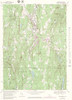
| Jewett City Quadrangle 1944 - USGS Topographic Map 1:31,680 |
JEWETT CITY |
1944 |
1:31,680 |
USGS |
Coming Soon |
1 |
 |
 |
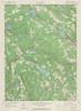
| Jewett City Quadrangle 1953 - USGS Topographic Map 1:24,000 |
JEWETT CITY |
1953 |
1:24,000 |
USGS |
Coming Soon |
1 |
|
 |
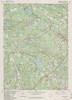
| Jewett City Quadrangle 1970 - USGS Topographic Map 1:24,000 |
JEWETT CITY |
1970 |
1:24,000 |
USGS |
Coming Soon |
1 |
|
 |
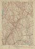
| Jewett City Quadrangle 1984 - USGS Topographic Map 1:24,000 |
JEWETT CITY |
1984 |
1:24,000 |
USGS |
Coming Soon |
1 |
|
 |
| Kent Quadrangle 1950 - USGS Topographic Map 1:31,680 |
KENT |
1950 |
1:31,680 |
USGS |
Coming Soon |
1 |
|
 |
| Kent Quadrangle 1955 - USGS Topographic Map 1:24,000 |
KENT |
1955 |
1:24,000 |
USGS |
Coming Soon |
1 |
|
 |
| Kent Quadrangle 1971 - USGS Topographic Map 1:24,000 |
KENT |
1971 |
1:24,000 |
USGS |
Coming Soon |
1 |
|
 |
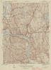
| Litchfield Quadrangle 1923 - USGS Topographic Map 1:125,000 |
LITCHFIELD |
1923 |
1:125,000 |
USGS |
Coming Soon |
1 |
|
 |
| Litchfield Quadrangle 1943 - USGS Topographic Map 1:125,000 |
LITCHFIELD |
1943 |
1:125,000 |
USGS |
Coming Soon |
1 |
|
 |
| Litchfield Quadrangle 1950 - USGS Topographic Map 1:31,680 |
LITCHFIELD |
1950 |
1:31,680 |
USGS |
Coming Soon |
1 |
|
 |
| Litchfield Quadrangle 1956 - USGS Topographic Map 1:24,000 |
LITCHFIELD |
1956 |
1:24,000 |
USGS |
Coming Soon |
1 |
|
 |
| Litchfield Quadrangle 1970 - USGS Topographic Map 1:24,000 |
LITCHFIELD |
1970 |
1:24,000 |
USGS |
Coming Soon |
1 |
|
 |
| Litchfield Quadrangle 1984 - USGS Topographic Map 1:24,000 |
LITCHFIELD |
1984 |
1:24,000 |
USGS |
Coming Soon |
1 |
|
 |
| Lloyd Harbor Quadrangle 1954 - USGS Topographic Map 1:24,000 |
LLOYD HARBOR NY |
1954 |
1:24,000 |
USGS |
Coming Soon |
1 |
|
 |
| Lloyd Harbor Quadrangle 1967 - USGS Topographic Map 1:24,000 |
LLOYD HARBOR NY |
1967 |
1:24,000 |
USGS |
Coming Soon |
1 |
|
 |
| Long Hill Quadrangle 1947 - USGS Topographic Map 1:31,680 |
LONG HILL |
1947 |
1:31,680 |
USGS |
Coming Soon |
1 |
|
 |
| Long Hill Quadrangle 1953 - USGS Topographic Map 1:24,000 |
LONG HILL |
1953 |
1:24,000 |
USGS |
Coming Soon |
1 |
|
 |
| Long Hill Quadrangle 1964 - USGS Topographic Map 1:24,000 |
LONG HILL |
1964 |
1:24,000 |
USGS |
Coming Soon |
1 |
|
 |
| Long Hill Quadrangle 1973 - USGS Topographic Map 1:24,000 |
LONG HILL |
1973 |
1:24,000 |
USGS |
Coming Soon |
1 |
|
 |
| Long Hill Quadrangle 1984 - USGS Topographic Map 1:24,000 |
LONG HILL |
1984 |
1:24,000 |
USGS |
Coming Soon |
1 |
|
 |
| Lyme Quadrangle 1938 - USGS Topographic Map 1:31,680 |
LYME |
1938 |
1:31,6800 |
USGS |
Coming Soon |
1 |
|
 |
| Lyme Quadrangle 1949 - USGS Topographic Map 1:31,680 |
LYME |
1949 |
1:31,6800 |
USGS |
Coming Soon |
1 |
|
 |
| Mamaroneck Quadrangle 1947 - USGS Topographic Map 1:24,000 |
MAMARONECK |
1947 |
1:24,000 |
USGS |
Coming Soon |
1 |
|
 |
| Mamaroneck Quadrangle 1955 - USGS Topographic Map 1:24,000 |
MAMARONECK |
1955 |
1:24,000 |
USGS |
Coming Soon |
1 |
|
 |
| Mamaroneck Quadrangle 1967 - USGS Topographic Map 1:24,000 |
MAMARONECK |
1967 |
1:24,000 |
USGS |
Coming Soon |
1 |
|
 |
| Manchester Quadrangle 1943 - USGS Topographic Map 1:31,680 |
MANCHESTER |
1943 |
1:31,680 |
USGS |
Coming Soon |
1 |
|
 |
| Manchester Quadrangle 1944 - USGS Topographic Map 1:31,680 |
MANCHESTER |
1944 |
1:31,680 |
USGS |
Coming Soon |
1 |
|
 |
| Manchester Quadrangle 1952 - USGS Topographic Map 1:24,000 |
MANCHESTER |
1952 |
1:24,000 |
USGS |
Coming Soon |
1 |
|
 |
| Manchester Quadrangle 1963 - USGS Topographic Map 1:24,000 |
MANCHESTER |
1963 |
1:24,000 |
USGS |
Coming Soon |
1 |
|
 |
| Manchester Quadrangle 1968 - USGS Topographic Map 1:24,000 |
MANCHESTER |
1968 |
1:24,000 |
USGS |
Coming Soon |
1 |
|
 |
| Manchester Quadrangle 1984 - USGS Topographic Map 1:24,000 |
MANCHESTER |
1984 |
1:24,000 |
USGS |
Coming Soon |
1 |
|
 |
| Manchester Quadrangle 1992 - USGS Topographic Map 1:24,000 |
MANCHESTER |
1992 |
1:24000 |
USGS |
Coming Soon |
1 |
|
 |
| Marlborough Quadrangle 1944 - USGS Topographic Map 1:31,680 |
MARLBOROUGH |
1944 |
1:31,680 |
USGS |
Coming Soon |
1 |
|
 |
| Marlborough Quadrangle 1944 - USGS Topographic Map 1:31,680 |
MARLBOROUGH |
1944 |
1:31,680 |
USGS |
Coming Soon |
2 |
|
 |
| Marlborough Quadrangle 1953 - USGS Topographic Map 1:24,000 |
MARLBOROUGH |
1953 |
1:24,000 |
USGS |
Coming Soon |
1 |
|
 |
| Marlborough Quadrangle 1967 - USGS Topographic Map 1:24,000 |
MARLBOROUGH |
1967 |
1:24,000 |
USGS |
Coming Soon |
1 |
|
 |
| Marlborough Quadrangle 1972 - USGS Topographic Map 1:24,000 |
MARLBOROUGH |
1972 |
1:24,000 |
USGS |
Coming Soon |
1 |
|
 |
| Meriden Sheet 1913 - USGS Topographic Map 1:62,500 |
MERIDEN |
1913 |
1:62,500 |
USGS |
Coming Soon |
1 |
|
 |
| Meriden Sheet 1941 - USGS Topographic Map 1:62,500 |
MERIDEN |
1941 |
1:62,500 |
USGS |
Coming Soon |
1 |
|
 |
| Meriden Quadrangle 1946 - USGS Topographic Map 1:31,680 |
MERIDEN |
1946 |
1:31,680 |
USGS |
Coming Soon |
1 |
|
 |
| Meriden Quadrangle 1955 - USGS Topographic Map 1:24,000 |
MERIDEN |
1955 |
1:24,000 |
USGS |
Coming Soon |
1 |
|
 |
| Meriden Quadrangle 1967 - USGS Topographic Map 1:24,000 |
MERIDEN |
1967 |
1:24,000 |
USGS |
Coming Soon |
1 |
|
 |
| Meriden Quadrangle 1972 - USGS Topographic Map 1:24,000 |
MERIDEN |
1972 |
1:24,000 |
USGS |
Coming Soon |
1 |
|
 |
| Meriden Quadrangle 1976 - USGS Topographic Map 1:24,000 |
MERIDEN |
1976 |
1:24,000 |
USGS |
Coming Soon |
1 |
|
 |
| Meriden Quadrangle 1984 - USGS Topographic Map 1:24,000 |
MERIDEN |
1984 |
1:24,000 |
USGS |
Coming Soon |
1 |
|
 |
| Meriden Quadrangle 1992 - USGS Topographic Map 1:24,000 |
MERIDEN |
1992 |
1:24,000 |
USGS |
Coming Soon |
1 |
|
 |
| Middle Haddam Quadrangle 1945 - USGS Topographic Map 1:31,680 |
MIDDLE HADDAM |
1945 |
1:31,680 |
USGS |
Coming Soon |
1 |
|
 |
| Middle Haddam Quadrangle 1952 - USGS Topographic Map 1:31,680 |
MIDDLE HADDAM |
1952 |
1:31,680 |
USGS |
Coming Soon |
1 |
|
 |
| Middle Haddam Quadrangle 1961 - USGS Topographic Map 1:24,000 |
MIDDLE HADDAM |
1961 |
1:24,000 |
USGS |
Coming Soon |
1 |
|
 |
| Middle Haddam Quadrangle 1971 - USGS Topographic Map 1:24,000 |
MIDDLE HADDAM |
1971 |
1:24,000 |
USGS |
Coming Soon |
1 |
|
 |
| Middle Haddam Quadrangle 1984 - USGS Topographic Map 1:24,000 |
MIDDLE HADDAM |
1984 |
1:24,000 |
USGS |
Coming Soon |
1 |
|
 |
| Middletown Sheet 1910 - USGS Topographic Map 1:62,500 |
MIDDLETOWN |
1910 |
1:62,500 |
USGS |
Coming Soon |
1 |
|
 |
| Middletown Quadrangle 1915 - USGS Topographic Map 1:62,500 |
MIDDLETOWN |
1915 |
1:62,500 |
USGS |
Coming Soon |
1 |
|
 |
| Middletown Quadrangle 1942 - USGS Topographic Map 1:62,500 |
MIDDLETOWN |
1942 |
1:62,500 |
USGS |
Coming Soon |
1 |
|
 |
| Middletown Quadrangle 1945 - USGS Topographic Map 1:31,680 |
MIDDLETOWN |
1945 |
1:31,680 |
USGS |
Coming Soon |
1 |
|
 |
| Middletown Quadrangle 1952 - USGS Topographic Map 1:24,000 |
MIDDLETOWN |
1952 |
1:24,000 |
USGS |
Coming Soon |
1 |
|
 |
| Middletown Quadrangle 1965 - USGS Topographic Map 1:24,000 |
MIDDLETOWN |
1965 |
1:24,000 |
USGS |
Coming Soon |
1 |
|
 |
| Middletown Quadrangle 1972 - USGS Topographic Map 1:24,000 |
MIDDLETOWN |
1972 |
1:24,000 |
USGS |
Coming Soon |
1 |
|
 |
| Middletown Quadrangle 1984 - USGS Topographic Map 1:24,000 |
MIDDLETOWN |
1984 |
1:24,000 |
USGS |
Coming Soon |
1 |
|
 |
| Middletown Quadrangle 1992 - USGS Topographic Map 1:24,000 |
MIDDLETOWN |
1992 |
1:24,000 |
USGS |
Coming Soon |
1 |
|
 |
| Milford Quadrangle 1951 - USGS Topographic Map 1:31,680 |
MILFORD |
1951 |
1:31,680 |
USGS |
Coming Soon |
1 |
|
 |
| Milford Quadrangle 1960 - USGS Topographic Map 1:24,000 |
MILFORD |
1960 |
1:24,000 |
USGS |
Coming Soon |
1 |
|
 |
| Milford Quadrangle 1971 - USGS Topographic Map 1:24,000 |
MILFORD |
1971 |
1:24,000 |
USGS |
Coming Soon |
1 |
|
 |
| Milford Quadrangle 1984 - USGS Topographic Map 1:24,000 |
MILFORD |
1984 |
1:24,000 |
USGS |
Coming Soon |
1 |
|
 |
| Millerton Quadrangle 1955 - USGS Topographic Map 1:24,000 |
MILLERTON |
1955 |
1:24,000 |
USGS |
Coming Soon |
1 |
|
 |
| Monson Quadrangle 1946 - USGS Topographic Map 1:31,680 |
MONSON |
1946 |
1:31,680 |
USGS |
Coming Soon |
1 |
|
 |
| Monson Quadrangle 1953 - USGS Topographic Map 1:24,000 |
MONSON |
1953 |
1:24,000 |
USGS |
Coming Soon |
1 |
|
 |
| Monson Quadrangle 1967 - USGS Topographic Map 1:24,000 |
MONSON |
1967 |
1:24,000 |
USGS |
Coming Soon |
1 |
|
 |
| Monson Quadrangle 1979 - USGS Topographic Map 1:24,000 |
MONSON |
1979 |
1:25,000 |
USGS |
Coming Soon |
1 |
|
 |
| Montville Quadrangle 1950 - USGS Topographic Map 1:31,680 |
MONTVILLE |
1950 |
1:31,680 |
USGS |
Coming Soon |
1 |
|
 |
| Montville Quadrangle 1958 - USGS Topographic Map 1:24,000 |
MONTVILLE |
1958 |
1:24,000 |
USGS |
Coming Soon |
1 |
|
 |
| Montville Quadrangle 1970 - USGS Topographic Map 1:24,000 |
MONTVILLE |
1970 |
1:24,000 |
USGS |
Coming Soon |
1 |
|
 |
| Montville Quadrangle 1983 - USGS Topographic Map 1:24,000 |
MONTVILLE |
1983 |
1:24,000 |
USGS |
Coming Soon |
1 |
|
 |
| Moodus Quadrangle 1946 - USGS Topographic Map 1:31,680 |
MOODUS |
1946 |
1:31,680 |
USGS |
Coming Soon |
1 |
|
 |
| Moodus Quadrangle 1952 - USGS Topographic Map 1:24,000 |
MOODUS |
1952 |
1:24,000 |
USGS |
Coming Soon |
1 |
|
 |
| Moodus Quadrangle 1967 - USGS Topographic Map 1:24,000 |
MOODUS |
1967 |
1:24,000 |
USGS |
Coming Soon |
1 |
|
 |
| Moodus Quadrangle 1973 - USGS Topographic Map 1:24,000 |
MOODUS |
1973 |
1:24,000 |
USGS |
Coming Soon |
1 |
|
 |
| Moosup Sheet 1912 - USGS Topographic Map 1:62,500 |
MOOSUP |
1912 |
1:62,500 |
USGS |
Coming Soon |
1 |
|
 |
| Moosup Sheet 1932 - USGS Topographic Map 1:62,500 |
MOOSUP |
1932 |
1:62,500 |
USGS |
Coming Soon |
1 |
|
 |
| Moosup Sheet 1941 - USGS Topographic Map 1:62,500 |
MOOSUP |
1941 |
1:62,500 |
USGS |
Coming Soon |
1 |
|
 |
| Mount Carmel Quadrangle 1954 - USGS Topographic Map 1:24,000 |
MOUNT CARMEL |
1954 |
1:24,000 |
USGS |
Coming Soon |
1 |
|
 |
| Mount Carmel Quadrangle 1967 - USGS Topographic Map 1:24,000 |
MOUNT CARMEL |
1967 |
1:24,000 |
USGS |
Coming Soon |
1 |
|
 |
| Mount Carmel Quadrangle 1972 - USGS Topographic Map 1:24,000 |
MOUNT CARMEL |
1972 |
1:24,000 |
USGS |
Coming Soon |
1 |
|
 |
| Mount Carmel Quadrangle 1984 - USGS Topographic Map 1:24,000 |
MOUNT CARMEL |
1984 |
1:24,000 |
USGS |
Coming Soon |
1 |
|
 |
| Mount Kisco Quadrangle 1955 - USGS Topographic Map 1:24,000 |
MOUNT KISCO |
1955 |
1:24,000 |
USGS |
Coming Soon |
1 |
|
 |
| Mount Kisco Quadrangle 1971 - USGS Topographic Map 1:24,000 |
MOUNT KISCO |
1971 |
1:24,000 |
USGS |
Coming Soon |
1 |
|
 |
| Mount Kisco Quadrangle 1998 - USGS Topographic Map 1:24,000 |
MOUNT KISCO |
1998 |
1:24,000 |
USGS |
Coming Soon |
1 |
|
 |
| Mystic Quadrangle 1944 - USGS Topographic Map 1:31,680 |
MYSTIC |
1944 |
1:31,680 |
USGS |
Coming Soon |
1 |
|
 |
| Mystic Quadrangle 1947 - USGS Topographic Map 1:25,000 |
MYSTIC |
1947 |
1:25,000 |
USGS |
Coming Soon |
1 |
|
 |
| Mystic Quadrangle 1949 - USGS Topographic Map 1:31,680 |
MYSTIC |
1949 |
1:31,680 |
USGS |
Coming Soon |
1 |
|
 |
| Mystic Quadrangle 1958 - USGS Topographic Map 1:24,000 |
MYSTIC |
1958 |
1:24,000 |
USGS |
Coming Soon |
1 |
|
 |
| Mystic Quadrangle 1970 - USGS Topographic Map 1:24,000 |
MYSTIC |
1970 |
1:24,000 |
USGS |
Coming Soon |
1 |
|
 |
| Mystic Quadrangle 1984- USGS Topographic Map 1:24,000 |
MYSTIC |
1984 |
1:24,000 |
USGS |
Coming Soon |
1 |
|
 |
| Naugatuck Quadrangle 1954 - USGS Topographic Map 1:24,000 |
NAUGATUCK |
1954 |
1:24,000 |
USGS |
Coming Soon |
1 |
|
 |
| Naugatuck Quadrangle 1964 - USGS Topographic Map 1:24,000 |
NAUGATUCK |
1964 |
1:24,000 |
USGS |
Coming Soon |
1 |
|
 |
| Naugatuck Quadrangle 1972 - USGS Topographic Map 1:24,000 |
NAUGATUCK |
1972 |
1:24,000 |
USGS |
Coming Soon |
1 |
|
 |
| Naugatuck Quadrangle 1984 - USGS Topographic Map 1:24,000 |
NAUGATUCK |
1984 |
1:24,000 |
USGS |
Coming Soon |
1 |
|
 |
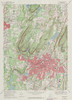
| New Britain Quadrangle 1946 - USGS Topographic Map 1:31,680 |
NEW BRITAIN |
1946 |
1:31,680 |
USGS |
Coming Soon |
1 |
|
 |
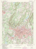
| New Britain Quadrangle 1953 - USGS Topographic Map 1:24,000 |
NEW BRITAIN |
1953 |
1:24,000 |
USGS |
Coming Soon |
1 |
|
 |
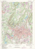
| New Britain Quadrangle 1966 - USGS Topographic Map 1:24,000 |
NEW BRITAIN |
1966 |
1:24,000 |
USGS |
Coming Soon |
1 |
|
 |
| New Britain Quadrangle 1972 - USGS Topographic Map 1:24,000 |
NEW BRITAIN |
1972 |
1:24,000 |
USGS |
Coming Soon |
1 |
|
 |
| New Britain Quadrangle 1984 - USGS Topographic Map 1:24,000 |
NEW BRITAIN |
1984 |
1:24,000 |
USGS |
Coming Soon |
1 |
|
 |
| New Britain Quadrangle 1992 - USGS Topographic Map 1:24,000 |
NEW BRITAIN |
1992 |
1:24,000 |
USGS |
Coming Soon |
1 |
|
 |
| New Hartford Quadrangle 1951 - USGS Topographic Map 1:31,680 |
NEW HARTFORD |
1951 |
1:31,680 |
USGS |
Coming Soon |
1 |
|
 |
| New Hartford Quadrangle 1956 - USGS Topographic Map 1:24,000 |
NEW HARTFORD |
1956 |
1:24,000 |
USGS |
Coming Soon |
1 |
|
 |
| New Hartford Quadrangle 1971 - USGS Topographic Map 1:24,000 |
NEW HARTFORD |
1971 |
1:24,000 |
USGS |
Coming Soon |
1 |
|
 |
| New Hartford Quadrangle 1984 - USGS Topographic Map 1:24,000 |
NEW HARTFORD |
1984 |
1:24,000 |
USGS |
Coming Soon |
1 |
|
 |
| New Haven Quadrangle 1890 - USGS Topographic Map 1:62,500 |
NEW HAVEN |
1890 |
1:62,500 |
USGS |
Coming Soon |
1 |
|
 |
| New Haven Quadrangle 1942 - USGS Topographic Map 1:125,000 |
NEW HAVEN |
1942 |
1:125,000 |
USGS |
Coming Soon |
1 |
|
 |
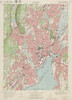
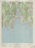
| New Haven Quadrangle 1954 - USGS Topographic Map 1:24,000 |
NEW HAVEN |
1954 |
1:24,000 |
USGS |
Coming Soon |
1 |
|
 |
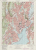
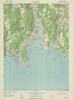
| New Haven Quadrangle 1954 - USGS Topographic Map 1:24,000 |
NEW HAVEN |
1954 |
1:24,000 |
USGS |
Coming Soon |
1 |
|
 |
| New Haven Quadrangle 1967 - USGS Topographic Map 1:24,000 |
NEW HAVEN |
1967 |
1:24,000 |
USGS |
Coming Soon |
1 |
|
 |
| New Haven Quadrangle 1972 - USGS Topographic Map 1:24,000 |
NEW HAVEN |
1972 |
1:24,000 |
USGS |
Coming Soon |
1 |
|
 |
| New Haven Quadrangle 1984 - USGS Topographic Map 1:24,000 |
NEW HAVEN |
1984 |
1:24,000 |
USGS |
Coming Soon |
1 |
|
 |
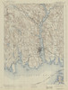
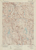
| New London Quadrangle 1890 - USGS Topographic Map 1:62,500 |
NEW LONDON |
1890 |
1:62,500 |
USGS |
Coming Soon |
1 |
|
 |
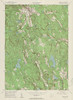
| New London Quadrangle 1938 - USGS Topographic Map 1:31,680 |
NEW LONDON |
1938 |
1:31,680 |
USGS |
Coming Soon |
1 |
|
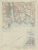 |
| New London Quadrangle 1942 - USGS Topographic Map 1:125,000 |
NEW LONDON |
1942 |
1:125,000 |
USGS |
Coming Soon |
1 |
|
 |
| New London Quadrangle 1958 - USGS Topographic Map 1:24,000 |
NEW LONDON |
1958 |
1:24,000 |
USGS |
Coming Soon |
1 |
|
 |
| New London Quadrangle 1970 - USGS Topographic Map 1:24,000 |
NEW LONDON |
1970 |
1:24,000 |
USGS |
Coming Soon |
1 |
|
 |
| New London Quadrangle 1984 - USGS Topographic Map 1:24,000 |
NEW LONDON |
1984 |
1:24,000 |
USGS |
Coming Soon |
1 |
|
 |
| New Milford Quadrangle 1889 - USGS Topographic Map 1:62,500 |
NEW MILFORD |
1889 |
1:62,500 |
USGS |
Coming Soon |
1 |
|
 |
| New Milford Quadrangle 1955 - USGS Topographic Map 1:24,000 |
NEW MILFORD |
1955 |
1:24,000 |
USGS |
Coming Soon |
1 |
|
 |
| New Milford Quadrangle 1971 - USGS Topographic Map 1:24,000 |
NEW MILFORD |
1971 |
1:24,000 |
USGS |
Coming Soon |
1 |
|
 |
| New Milford Quadrangle 1984 - USGS Topographic Map 1:24,000 |
NEW MILFORD |
1984 |
1:24,000 |
USGS |
Coming Soon |
1 |
|
 |
| New Preston Quadrangle 1950 - USGS Topographic Map 1:31,680 |
NEW PRESTON |
1950 |
1:31,680 |
USGS |
Coming Soon |
1 |
|
 |
| New Preston Quadrangle 1955 - USGS Topographic Map 1:24,000 |
NEW PRESTON |
1955 |
1:24,000 |
USGS |
Coming Soon |
1 |
|
 |
| New Preston Quadrangle 1971 - USGS Topographic Map 1:24,000 |
NEW PRESTON |
1971 |
1:24,000 |
USGS |
Coming Soon |
1 |
|
 |
| New Preston Quadrangle 1984 - USGS Topographic Map 1:24,000 |
NEW PRESTON |
1984 |
1:24,000 |
USGS |
Coming Soon |
1 |
|
 |
| Newtown Quadrangle 1953 - USGS Topographic Map 1:24,000 |
NEWTOWN |
1953 |
1:24,000 |
USGS |
Coming Soon |
1 |
|
 |
| Newtown Quadrangle 1963 - USGS Topographic Map 1:24,000 |
NEWTOWN |
1963 |
1:24,000 |
USGS |
Coming Soon |
1 |
|
 |
| Newtown Quadrangle 1972 - USGS Topographic Map 1:24,000 |
NEWTOWN |
1972 |
1:24,000 |
USGS |
Coming Soon |
1 |
|
 |
| Newtown Quadrangle 1984 - USGS Topographic Map 1:24,000 |
NEWTOWN |
1984 |
1:24,000 |
USGS |
Coming Soon |
1 |
|
 |
| Niantic Quadrangle 1938 - USGS Topographic Map 1:31,680 |
NIANTIC |
1938 |
1:31,680 |
USGS |
Coming Soon |
1 |
|
 |
| Niantic Quadrangle 1958 - USGS Topographic Map 1:24,000 |
NIANTIC |
1958 |
1:24,000 |
USGS |
Coming Soon |
1 |
|
 |
| Niantic Quadrangle 1970 - USGS Topographic Map 1:24,000 |
NIANTIC |
1970 |
1:24,000 |
USGS |
Coming Soon |
1 |
|
 |
| Niantic Quadrangle 1983 - USGS Topographic Map 1:24,000 |
NIANTIC |
1983 |
1:24,000 |
USGS |
Coming Soon |
1 |
|
 |
| Norfolk Quadrangle 1951 - USGS Topographic Map 1:31,680 |
NORFOLK |
1951 |
1:31,680 |
USGS |
Coming Soon |
1 |
|
 |
| Norfolk Quadrangle 1956 - USGS Topographic Map 1:24,000 |
NORFOLK |
1956 |
1:24,000 |
USGS |
Coming Soon |
1 |
|
 |
| Norfolk Quadrangle 1969 - USGS Topographic Map 1:24,000 |
NORFOLK |
1969 |
1:24,000 |
USGS |
Coming Soon |
1 |
|
 |
| Norwalk Sheet 1889 - USGS Topographic Map 1:62,500 |
NORWALK |
1889 |
1:62,500 |
USGS |
Coming Soon |
1 |
|
 |
| Norwalk North Quadrangle 1951 - USGS Topographic Map 1:24,000 |
NORWALK NORTH |
1951 |
1:24,000 |
USGS |
Coming Soon |
1 |
|
 |
| Norwalk North Quadrangle 1960 - USGS Topographic Map 1:24,000 |
NORWALK NORTH |
1960 |
1:24,000 |
USGS |
Coming Soon |
1 |
|
 |
| Norwalk North Quadrangle 1971 - USGS Topographic Map 1:24,000 |
NORWALK NORTH |
1971 |
1:24,000 |
USGS |
Coming Soon |
1 |
|
 |
| Norwalk North Quadrangle 1975 - USGS Topographic Map 1:24,000 |
NORWALK NORTH |
1975 |
1:24,000 |
USGS |
Coming Soon |
1 |
|
 |
| Norwalk South Quadrangle 1947 - USGS Topographic Map 1:31,680 |
NORWALK SOUTH |
1947 |
1:31,680 |
USGS |
Coming Soon |
1 |
|
 |
| Norwalk South Quadrangle 1951 - USGS Topographic Map 1:31,680 |
NORWALK SOUTH |
1951 |
1:31,680 |
USGS |
Coming Soon |
1 |
|
 |
| Norwalk South Quadrangle 1960 - USGS Topographic Map 1:24,000 |
NORWALK SOUTH |
1960 |
1:24,000 |
USGS |
Coming Soon |
1 |
|
 |
| Norwalk South Quadrangle 1971 - USGS Topographic Map 1:24,000 |
NORWALK SOUTH |
1971 |
1:24,000 |
USGS |
Coming Soon |
1 |
|
 |
| Norwalk South Quadrangle 1984 - USGS Topographic Map 1:24,000 |
NORWALK SOUTH |
1984 |
1:24,000 |
USGS |
Coming Soon |
1 |
|
 |
| Norwich Sheet 1890 - USGS Topographic Map 1:62,500 |
NORWICH |
1890 |
1:62,500 |
USGS |
Coming Soon |
1 |
|
 |
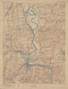
| Norwich Quadrangle 1946 - USGS Topographic Map 1:31,680 |
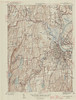
NORWICH |
1946 |
1:31,680 |
USGS |
Coming Soon |
1 |
|
 |
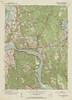
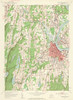
| Norwich Quadrangle 1954 - USGS Topographic Map 1:24,000 |
NORWICH |
1954 |
1:24,000 |
USGS |
Coming Soon |
1 |
|
 |
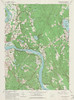
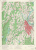
| Norwich Quadrangle 1970 - USGS Topographic Map 1:24,000 |
NORWICH |
1970 |
1:24,000 |
USGS |
Coming Soon |
1 |
|
 |
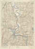
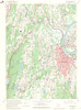
| Norwich Quadrangle 1983 - USGS Topographic Map 1:24,000 |
NORWICH |
1983 |
1:24,000 |
USGS |
Coming Soon |
1 |
|
 |
