The following listing includes USGS topographic maps from MAGIC's collections along with the ability to view and download each map in JPEG or full quality TIFF formats. The TIFF images include the GeoTIFF file format for those that need a georeferenced version of the topographic map for use in GIS software programs.
Title |
Quadrangle |
Year |
Scale |
Source |
Metadata |
Series # |
Download Georeferenced TIFF
|
Preview & Download JPEG |
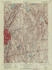
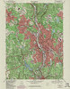
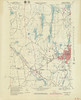
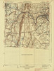
| Tariffville Quadrangle 1951 - USGS Topographic Map 1:31,680 |
TARIFFVILLE |
1951 |
1:31,680 |
USGS |
Coming Soon |
1 |
 |
 |
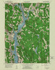
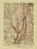
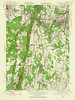
| Tariffville Quadrangle 1956 - USGS Topographic Map 1:24,000 |
TARIFFVILLE |
1956 |
1:24,000 |
USGS |
Coming Soon |
1 |
|
 |
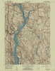
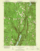
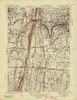
| Tariffville Quadrangle 1970 - USGS Topographic Map 1:24,000 |
TARIFFVILLE |
1970 |
1:24,000 |
USGS |
Coming Soon |
1 |
|
 |
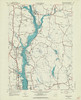
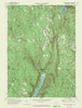
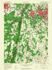
| Tariffville Quadrangle 1970 - USGS Topographic Map 1:24,000 |
TARIFFVILLE |
1970 |
1:24,000 |
USGS |
Coming Soon |
2 |
|
 |
| Tariffville Quadrangle 1984 - USGS Topographic Map 1:24,000 |
TARIFFVILLE |
1984 |
1:24,000 |
USGS |
Coming Soon |
1 |
|
 |
| Thomaston Quadrangle 1951 - USGS Topographic Map 1:31,680 |
THOMASTON |
1951 |
1:31,680 |
USGS |
Coming Soon |
1 |
|
 |
| Thomaston Quadrangle 1951 - USGS Topographic Map 1:31,680 |
THOMASTON |
1951 |
1:31,680 |
USGS |
Coming Soon |
2 |
|
 |
| Thomaston Quadrangle 1956 - USGS Topographic Map 1:24,000 |
THOMASTON |
1956 |
1:24,000 |
USGS |
Coming Soon |
1 |
|
 |
| Thomaston Quadrangle 1956 - USGS Topographic Map 1:24,000 |
THOMASTON |
1956 |
1:24,000 |
USGS |
Coming Soon |
2 |
|
 |
| Thomaston Quadrangle 1969 - USGS Topographic Map 1:24,000 |
THOMASTON |
1969 |
1:24,000 |
USGS |
Coming Soon |
1 |
|
 |
| Thomaston Quadrangle 1969 - USGS Topographic Map 1:24,000 |
THOMASTON |
1969 |
1:24,000 |
USGS |
Coming Soon |
2 |
|
 |
| Thomaston Quadrangle 1969 - USGS Topographic Map 1:24,000 |
THOMASTON |
1969 |
1:24,000 |
USGS |
Coming Soon |
3 |
|
 |
| Thomaston Quadrangle 1976 - USGS Topographic Map 1:24,000 |
THOMASTON |
1976 |
1:24,000 |
USGS |
Coming Soon |
1 |
|
 |
| Thompson Quadrangle 1945 - USGS Topographic Map 1:31,680 |
THOMPSON |
1945 |
1:31,680 |
USGS |
Coming Soon |
1 |
|
 |
| Thompson Quadrangle 1955 - USGS Topographic Map 1:24,000 |
THOMPSON |
1955 |
1:24,000 |
USGS |
Coming Soon |
1 |
|
 |
| Thompson Quadrangle 1955 - USGS Topographic Map 1:24,000 |
THOMPSON |
1955 |
1:24,000 |
USGS |
Coming Soon |
2 |
|
 |
| Thompson Quadrangle 1970 - USGS Topographic Map 1:24,000 |
THOMPSON |
1970 |
1:24,000 |
USGS |
Coming Soon |
1 |
|
 |
| Thompson Quadrangle 1970 - USGS Topographic Map 1:24,000 |
THOMPSON |
1970 |
1:24,000 |
USGS |
Coming Soon |
2 |
|
 |
| Thompson Quadrangle 1970 - USGS Topographic Map 1:24,000 |
THOMPSON |
1970 |
1:24,000 |
USGS |
Coming Soon |
3 |
|
 |
| Thompson Quadrangle 1974 - USGS Topographic Map 1:24,000 |
THOMPSON |
1974 |
1:24,000 |
USGS |
Coming Soon |
1 |
|
 |
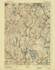
| Tolland Sheet Quadrangle 1892 - USGS Topographic Map 1:62,500 |
TOLLAND |
1892 |
1:62,500 |
USGS |
Coming Soon |
1 |
|
 |
| Tolland Center Quadrangle 1969 - USGS Topographic Map 1:24,000 |
TOLLAND CENTER |
1969 |
1:24,000 |
USGS |
Coming Soon |
1 |
|
 |
| Torrington Quadrangle 1951 - USGS Topographic Map 1:31,680 |
TORRINGTON |
1951 |
1:31,680 |
USGS |
Coming Soon |
1 |
|
 |
| Torrington Quadrangle 1956 - USGS Topographic Map 1:24,000 |
TORRINGTON |
1956 |
1:24,000 |
USGS |
Coming Soon |
1 |
|
 |
| Torrington Quadrangle 1956 - USGS Topographic Map 1:24,000 |
TORRINGTON |
1956 |
1:24,000 |
USGS |
Coming Soon |
2 |
|
 |
| Torrington Quadrangle 1969 - USGS Topographic Map 1:24,000 |
TORRINGTON |
1969 |
1:24,000 |
USGS |
Coming Soon |
1 |
|
 |
| Torrington Quadrangle 1969 - USGS Topographic Map 1:24,000 |
TORRINGTON |
1969 |
1:24,000 |
USGS |
Coming Soon |
2 |
|
 |
| Torrington Quadrangle 1984 - USGS Topographic Map 1:24,000 |
TORRINGTON |
1984 |
1:24,000 |
USGS |
Coming Soon |
1 |
|
 |
| Uncasville Quadrangle 1958 - USGS Topographic Map 1:24,000 |
UNCASVILLE |
1958 |
1:24,000 |
USGS |
Coming Soon |
1 |
|
 |
| Uncasville Quadrangle 1958 - USGS Topographic Map 1:24,000 |
UNCASVILLE |
1958 |
1:24,000 |
USGS |
Coming Soon |
2 |
|
 |
| Uncasville Quadrangle 1958 - USGS Topographic Map 1:24,000 |
UNCASVILLE |
1958 |
1:24,000 |
USGS |
Coming Soon |
3 |
|
 |
| Uncasville Quadrangle 1970 - USGS Topographic Map 1:24,000 |
UNCASVILLE |
1970 |
1:24,000 |
USGS |
Coming Soon |
1 |
|
 |
| Uncasville Quadrangle 1970 - USGS Topographic Map 1:24,000 |
UNCASVILLE |
1970 |
1:24,000 |
USGS |
Coming Soon |
2 |
|
 |
| Uncasville Quadrangle 1970 - USGS Topographic Map 1:24,000 |
UNCASVILLE |
1970 |
1:24,000 |
USGS |
Coming Soon |
3 |
|
 |
| Uncasville Quadrangle 1984 - USGS Topographic Map 1:24,000 |
UNCASVILLE |
1984 |
1:24,000 |
USGS |
Coming Soon |
1 |
|
 |
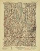
| Voluntown Quadrangle 1943 - USGS Topographic Map 1:31,680 |
VOLUNTOWN |
1943 |
1:31,680 |
USGS |
Coming Soon |
1 |
|
 |
| Voluntown Quadrangle 1953 - USGS Topographic Map 1:24,000 |
VOLUNTOWN |
1953 |
1:24,000 |
USGS |
Coming Soon |
1 |
|
 |
| Voluntown Quadrangle 1953 - USGS Topographic Map 1:24,000 |
VOLUNTOWN |
1953 |
1:24,000 |
USGS |
Coming Soon |
2 |
|
 |
| Voluntown Quadrangle 1970 - USGS Topographic Map 1:24,000 |
VOLUNTOWN |
1970 |
1:24,000 |
USGS |
Coming Soon |
1 |
|
 |
| Voluntown Quadrangle 1970 - USGS Topographic Map 1:24,000 |
VOLUNTOWN |
1970 |
1:24,000 |
USGS |
Coming Soon |
2 |
|
 |
| Voluntown Quadrangle 1975 - USGS Topographic Map 1:24,000 |
VOLUNTOWN |
1975 |
1:24,000 |
USGS |
Coming Soon |
1 |
|
 |
| Voluntown Quadrangle 1975 - USGS Topographic Map 1:24,000 |
VOLUNTOWN |
1975 |
1:24,000 |
USGS |
Coming Soon |
2 |
|
 |
| Voluntown Quadrangle 1975 - USGS Topographic Map 1:24,000 |
VOLUNTOWN |
1975 |
1:24,000 |
USGS |
Coming Soon |
3 |
|
 |
| Voluntown Quadrangle 2001 - USGS Topographic Map 1:24,000 |
VOLUNTOWN |
2001 |
1:24,000 |
USGS |
Coming Soon |
1 |
|
 |
| Wales Quadrangle 1952 - USGS Topographic Map 1:24,000 |
WALES |
1952 |
1:24,000 |
USGS |
Coming Soon |
1 |
|
 |
| Wales Quadrangle 1952 - USGS Topographic Map 1:24,000 |
WALES |
1952 |
1:24,000 |
USGS |
Coming Soon |
2 |
|
 |
| Wales Quadrangle 1967 - USGS Topographic Map 1:24,000 |
WALES |
1967 |
1:24,000 |
USGS |
Coming Soon |
1 |
|
 |
| Wales Quadrangle 1967 - USGS Topographic Map 1:24,000 |
WALES |
1967 |
1:24,000 |
USGS |
Coming Soon |
2 |
|
 |
| Wales Quadrangle 1979 - USGS Topographic Map 1:25,000 |
WALES |
1979 |
1:25,000 |
USGS |
Coming Soon |
1 |
|
 |
| Wallingford Quadrangle 1954 - USGS Topographic Map 1:31,680 |
WALLINGFORD |
1954 |
1:31,680 |
USGS |
Coming Soon |
1 |
|
 |
| Wallingford Quadrangle 1954 - USGS Topographic Map 1:24,000 |
WALLINGFORD |
1954 |
1:24,000 |
USGS |
Coming Soon |
1 |
|
 |
| Wallingford Quadrangle 1967 - USGS Topographic Map 1:24,000 |
WALLINGFORD |
1967 |
1:24,000 |
USGS |
Coming Soon |
1 |
|
 |
| Wallingford Quadrangle 1967 - USGS Topographic Map 1:24,000 |
WALLINGFORD |
1967 |
1:24,000 |
USGS |
Coming Soon |
2 |
|
 |
| Wallingford Quadrangle 1972 - USGS Topographic Map 1:24,000 |
WALLINGFORD |
1972 |
1:24,000 |
USGS |
Coming Soon |
1 |
|
 |
| Wallingford Quadrangle 1972 - USGS Topographic Map 1:24,000 |
WALLINGFORD |
1972 |
1:24,000 |
USGS |
Coming Soon |
2 |
|
 |
| Wallingford Quadrangle 1984 - USGS Topographic Map 1:24,000 |
WALLINGFORD |
1984 |
1:24,000 |
USGS |
Coming Soon |
1 |
|
 |
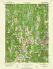
| Watch Hill Quadrangle 1970 - USGS Topographic Map 1:24,000 |
WATCH HILL |
1970 |
1:24,000 |
USGS |
Coming Soon |
1 |
|
 |
| Watch Hill Quadrangle 1975 - USGS Topographic Map 1:24,000 |
WATCH HILL |
1975 |
1:24,000 |
USGS |
Coming Soon |
1 |
|
 |
| Watch Hill Quadrangle 2001 - USGS Topographic Map 1:24,000 |
WATCH HILL |
2001 |
1:24,000 |
USGS |
Coming Soon |
1 |
|
 |
| Waterbury Quadrangle 1904 - USGS Topographic Map 1:62,500 |
WATERBURY |
1904 |
1:62,500 |
USGS |
Coming Soon |
1 |
|
 |
| Waterbury Quadrangle 1951 - USGS Topographic Map 1:31,680 |
WATERBURY |
1951 |
1:31,680 |
USGS |
Coming Soon |
1 |
|
 |
| Waterbury Quadrangle 1951 - USGS Topographic Map 1:31,680 |
WATERBURY |
1951 |
1:31,680 |
USGS |
Coming Soon |
2 |
|
 |
| Waterbury Quadrangle 1955 - USGS Topographic Map 1:24,000 |
WATERBURY |
1955 |
1:24,000 |
USGS |
Coming Soon |
1 |
|
 |
| Waterbury Quadrangle 1955 - USGS Topographic Map 1:24,000 |
WATERBURY |
1955 |
1:24,000 |
USGS |
Coming Soon |
2 |
|
 |
| Waterbury Quadrangle 1968 - USGS Topographic Map 1:24,000 |
WATERBURY |
1968 |
1:24,000 |
USGS |
Coming Soon |
1 |
|
 |
| Waterbury Quadrangle 1968 - USGS Topographic Map 1:24,000 |
WATERBURY |
1968 |
1:24,000 |
USGS |
Coming Soon |
2 |
|
 |
| Waterbury Quadrangle 1968 - USGS Topographic Map 1:24,000 |
WATERBURY |
1968 |
1:24,000 |
USGS |
Coming Soon |
3 |
|
 |
| Waterbury Quadrangle 1972 - USGS Topographic Map 1:24,000 |
WATERBURY |
1972 |
1:24,000 |
USGS |
Coming Soon |
1 |
|
 |
| Waterbury Quadrangle 1972 - USGS Topographic Map 1:24,000 |
WATERBURY |
1972 |
1:24,000 |
USGS |
Coming Soon |
2 |
|
 |
| Waterbury Quadrangle 1984 - USGS Topographic Map 1:24,000 |
WATERBURY |
1984 |
1:24,000 |
USGS |
Coming Soon |
1 |
|
 |
| Webster Quadrangle 1887 - USGS Topographic Map 1:62,500 |
WEBSTER |
1887 |
1:62,500 |
USGS |
Coming Soon |
1 |
|
 |
| Webster Quadrangle 1892 - USGS Topographic Map 1:62,500 |
WEBSTER |
1892 |
1:62,500 |
USGS |
Coming Soon |
1 |
|
 |
| Webster Quadrangle 1945 - USGS Topographic Map 1:31,680 |
WEBSTER |
1945 |
1:31,680 |
USGS |
Coming Soon |
1 |
|
 |
| Webster Quadrangle 1953 - USGS Topographic Map 1:24,000 |
WEBSTER |
1953 |
1:24,000 |
USGS |
Coming Soon |
1 |
|
 |
| Webster Quadrangle 1953 - USGS Topographic Map 1:24,000 |
WEBSTER |
1953 |
1:24,000 |
USGS |
Coming Soon |
2 |
|
 |
| Webster Quadrangle 1969 - USGS Topographic Map 1:24,000 |
WEBSTER |
1969 |
1:24,000 |
USGS |
Coming Soon |
1 |
|
 |
| Webster Quadrangle 1969 - USGS Topographic Map 1:24,000 |
WEBSTER |
1969 |
1:24,000 |
USGS |
Coming Soon |
2 |
|
 |
| Webster Quadrangle 1979 - USGS Topographic Map 1:25,000 |
WEBSTER |
1979 |
1:25,000 |
USGS |
Coming Soon |
1 |
|
 |
| Webster Quadrangle 1979 - USGS Topographic Map 1:25,000 |
WEBSTER |
1979 |
1:25,000 |
USGS |
Coming Soon |
2 |
|
 |
| Webster Quadrangle 1982 - USGS Topographic Map 1:25,000 |
WEBSTER |
1982 |
1:25,000 |
USGS |
Coming Soon |
1 |
|
 |
| West Granville Quadrangle 1946 - USGS Topographic Map 1:31,680 |
WEST GRANVILLE |
1946 |
1:31,680 |
USGS |
Coming Soon |
1 |
|
 |
| West Granville Quadrangle 1955 - USGS Topographic Map 1:24,000 |
WEST GRANVILLE |
1955 |
1:24,000 |
USGS |
Coming Soon |
1 |
|
 |
| West Granville Quadrangle 1971 - USGS Topographic Map 1:24,000 |
WEST GRANVILLE |
1971 |
1:24,000 |
USGS |
Coming Soon |
1 |
|
 |
| West Granville Quadrangle 1971 - USGS Topographic Map 1:24,000 |
WEST GRANVILLE |
1971 |
1:24,000 |
USGS |
Coming Soon |
2 |
|
 |
| West Springfield Quadrangle 1938 - USGS Topographic Map 1:31,680 |
WEST SPRINGFIELD |
1938 |
1:31,680 |
USGS |
Coming Soon |
1 |
|
 |
| West Springfield Quadrangle 1944 - USGS Topographic Map 1:24,000 |
WEST SPRINGFIELD |
1944 |
1:24,000 |
USGS |
Coming Soon |
1 |
|
 |
| West Springfield Quadrangle 1945 - USGS Topographic Map 1:31,680 |
WEST SPRINGFIELD |
1945 |
1:31,680 |
USGS |
Coming Soon |
1 |
|
 |
| West Springfield Quadrangle 1958 - USGS Topographic Map 1:24,000 |
WEST SPRINGFIELD |
1958 |
1:24,000 |
USGS |
Coming Soon |
1 |
|
 |
| West Springfield Quadrangle 1970 - USGS Topographic Map 1:24,000 |
WEST SPRINGFIELD |
1970 |
1:24,000 |
USGS |
Coming Soon |
1 |
|
 |
| West Springfield Quadrangle 1970 - USGS Topographic Map 1:24,000 |
WEST SPRINGFIELD |
1970 |
1:24,000 |
USGS |
Coming Soon |
2 |
|
 |
| West Torrington Quadrangle 1951 - USGS Topographic Map 1:31,680 |
WEST TORRINGTON |
1951 |
1:31,680 |
USGS |
Coming Soon |
1 |
|
 |
| West Torrington Quadrangle 1956 - USGS Topographic Map 1:24,000 |
WEST TORRINGTON |
1956 |
1:24,000 |
USGS |
Coming Soon |
1 |
|
 |
| West Torrington Quadrangle 1969 - USGS Topographic Map 1:24,000 |
WEST TORRINGTON |
1969 |
1:24,000 |
USGS |
Coming Soon |
1 |
|
 |
| West Torrington Quadrangle 1969 - USGS Topographic Map 1:24,000 |
WEST TORRINGTON |
1969 |
1:24,000 |
USGS |
Coming Soon |
2 |
|
 |
| West Torrington Quadrangle 1984 - USGS Topographic Map 1:24,000 |
WEST TORRINGTON |
1984 |
1:24,000 |
USGS |
Coming Soon |
1 |
|
 |
| Westford Quadrangle 1945 - USGS Topographic Map 1:31,680 |
WESTFORD |
1945 |
1:31,680 |
USGS |
Coming Soon |
1 |
|
 |
| Westford Quadrangle 1952 - USGS Topographic Map 1:24,000 |
WESTFORD |
1952 |
1:24,000 |
USGS |
Coming Soon |
1 |
|
 |
| Westford Quadrangle 1970 - USGS Topographic Map 1:24,000 |
WESTFORD |
1970 |
1:24,000 |
USGS |
Coming Soon |
1 |
|
 |
| Westford Quadrangle 1983 - USGS Topographic Map 1:24,000 |
WESTFORD |
1983 |
1:24,000 |
USGS |
Coming Soon |
1 |
|
 |
| Westport Quadrangle 1951 - USGS Topographic Map 1:31,680 |
WESTPORT |
1951 |
1:31,680 |
USGS |
Coming Soon |
1 |
|
 |
| Westport Quadrangle 1960 - USGS Topographic Map 1:24,000 |
WESTPORT |
1960 |
1:24,000 |
USGS |
Coming Soon |
1 |
|
 |
| Westport Quadrangle 1960 - USGS Topographic Map 1:24,000 |
WESTPORT |
1960 |
1:24,000 |
USGS |
Coming Soon |
2 |
|
 |
| Westport Quadrangle 1971 - USGS Topographic Map 1:24,000 |
WESTPORT |
1971 |
1:24,000 |
USGS |
Coming Soon |
1 |
|
 |
| Westport Quadrangle 1971 - USGS Topographic Map 1:24,000 |
WESTPORT |
1971 |
1:24,000 |
USGS |
Coming Soon |
2 |
|
 |
| Westport Quadrangle 1975 - USGS Topographic Map 1:24,000 |
WESTPORT |
1975 |
1:24,000 |
USGS |
Coming Soon |
1 |
|
 |
| Willimantic Quadrangle 1945 - USGS Topographic Map 1:31,680 |
WILLIMANTIC |
1945 |
1:31,680 |
USGS |
Coming Soon |
1 |
|
 |
| Willimantic Quadrangle 1953 - USGS Topographic Map 1:24,000 |
WILLIMANTIC |
1953 |
1:24,000 |
USGS |
Coming Soon |
1 |
|
 |
| Willimantic Quadrangle 1953 - USGS Topographic Map 1:24,000 |
WILLIMANTIC |
1953 |
1:24,000 |
USGS |
Coming Soon |
2 |
|
 |
| Willimantic Quadrangle 1953 - USGS Topographic Map 1:24,000 |
WILLIMANTIC |
1953 |
1:24,000 |
USGS |
Coming Soon |
3 |
|
 |
| Willimantic Quadrangle 1970 - USGS Topographic Map 1:24,000 |
WILLIMANTIC |
1970 |
1:24,000 |
USGS |
Coming Soon |
1 |
|
 |
| Willimantic Quadrangle 1970 - USGS Topographic Map 1:24,000 |
WILLIMANTIC |
1970 |
1:24,000 |
USGS |
Coming Soon |
2 |
|
 |
| Willimantic Quadrangle 1970 - USGS Topographic Map 1:24,000 |
WILLIMANTIC |
1970 |
1:24,000 |
USGS |
Coming Soon |
3 |
|
 |
| Willimantic Quadrangle 1984 - USGS Topographic Map 1:24,000 |
WILLIMANTIC |
1984 |
1:24,000 |
USGS |
Coming Soon |
1 |
|
 |
| Windsor Locks Quadrangle 1946 - USGS Topographic Map 1:31,680 |
WINDSOR LOCKS |
1946 |
1:31,680 |
USGS |
Coming Soon |
1 |
|
 |
| Windsor Locks Quadrangle 1953 - USGS Topographic Map 1:24,000 |
WINDSOR LOCKS |
1953 |
1:24,000 |
USGS |
Coming Soon |
1 |
|
 |
| Windsor Locks Quadrangle 1964 - USGS Topographic Map 1:24,000 |
WINDSOR LOCKS |
1964 |
1:24,000 |
USGS |
Coming Soon |
1 |
|
 |
| Windsor Locks Quadrangle 1972 - USGS Topographic Map 1:24,000 |
WINDSOR LOCKS |
1972 |
1:24,000 |
USGS |
Coming Soon |
1 |
|
 |
| Windsor Locks Quadrangle 1972 - USGS Topographic Map 1:24,000 |
WINDSOR LOCKS |
1972 |
1:24,000 |
USGS |
Coming Soon |
2 |
|
 |
| Windsor Locks Quadrangle 1984 - USGS Topographic Map 1:24,000 |
WINDSOR LOCKS |
1984 |
1:24,000 |
USGS |
Coming Soon |
1 |
|
 |
| Winsted Sheet 1892 - USGS Topographic Map 1:62,500 |
WINSTED |
1892 |
1:62,500 |
USGS |
Coming Soon |
1 |
|
 |
| Winsted Quadrangle 1951 - USGS Topographic Map 1:31,680 |
WINSTED |
1951 |
1:31,680 |
USGS |
Coming Soon |
1 |
|
 |
| Winsted Quadrangle 1956 - USGS Topographic Map 1:24,000 |
WINSTED |
1956 |
1:24,000 |
USGS |
Coming Soon |
1 |
|
 |
| Winsted Quadrangle 1969 - USGS Topographic Map 1:24,000 |
WINSTED |
1969 |
1:24,000 |
USGS |
Coming Soon |
1 |
|
 |
| Winsted Quadrangle 1969 - USGS Topographic Map 1:24,000 |
WINSTED |
1969 |
1:24,000 |
USGS |
Coming Soon |
2 |
|
 |
| Winsted Quadrangle 1984 - USGS Topographic Map 1:24,000 |
WINSTED |
1984 |
1:24,000 |
USGS |
Coming Soon |
1 |
|
 |
| Woodbury Quadrangle 1948 - USGS Topographic Map 1:31,680 |
WOODBURY |
1948 |
1:31,680 |
USGS |
Coming Soon |
1 |
|
 |
| Woodbury Quadrangle 1950 - USGS Topographic Map 1:31,680 |
WOODBURY |
1950 |
1:31,680 |
USGS |
Coming Soon |
1 |
|
 |
| Woodbury Quadrangle 1955 - USGS Topographic Map 1:24,000 |
WOODBURY |
1955 |
1:24,000 |
USGS |
Coming Soon |
1 |
|
 |
| Woodbury Quadrangle 1970 - USGS Topographic Map 1:24,000 |
WOODBURY |
1970 |
1:24,000 |
USGS |
Coming Soon |
1 |
|
 |
| Woodbury Quadrangle 1970 - USGS Topographic Map 1:24,000 |
WOODBURY |
1970 |
1:24,000 |
USGS |
Coming Soon |
2 |
|
 |
| Woodbury Quadrangle 1984 - USGS Topographic Map 1:24,000 |
WOODBURY |
1984 |
1:24,000 |
USGS |
Coming Soon |
1 |
|
 |
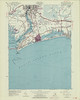
| Woodmont Quadrangle 1951 - USGS Topographic Map 1:24,000 |
WOODMONT |
1951 |
1:24,000 |
USGS |
Coming Soon |
1 |
|
 |
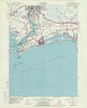
| Woodmont Quadrangle 1960 - USGS Topographic Map 1:24,000 |
WOODMONT |
1960 |
1:24,000 |
USGS |
Coming Soon |
1 |
|
 |
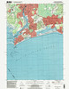
| Woodmont Quadrangle 1971 - USGS Topographic Map 1:24,000 |
WOODMONT |
1971 |
1:24,000 |
USGS |
Coming Soon |
1 |
|
 |
| Woodmont Quadrangle 1971 - USGS Topographic Map 1:24,000 |
WOODMONT |
1971 |
1:24,000 |
USGS |
Coming Soon |
2 |
|
 |
| Woodmont Quadrangle 1976 - USGS Topographic Map 1:24,000 |
WOODMONT |
1976 |
1:24,000 |
USGS |
Coming Soon |
1 |
|
 |
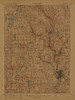
| Woodstock Sheet 1890 - USGS Topographic Map 1:62,500 |
WOODSTOCK |
1890 |
1:62,500 |
USGS |
Coming Soon |
1 |
|
 |
| Woodstock Sheet 1892 - USGS Topographic Map 1:62,500 |
WOODSTOCK |
1892 |
1:62,500 |
USGS |
Coming Soon |
1 |
|
 |
| Woodstock Quadrangle 1915 - USGS Topographic Map 1:62,500 |
WOODSTOCK |
1915 |
1:62,500 |
USGS |
Coming Soon |
1 |
|
 |
