
MAGIC Historical Map Collection - Europe
Included below are select maps from the University of Connecticut Library Map and Geographic Information Center - MAGIC collections which have been digitized. This collection will continue to grow so be sure to check back often. A copy of each map can be downloaded for use in your research or projects by clicking on the title or the view and download map image.
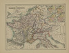
Europe - Continent and Regions


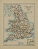
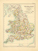
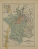
Europe - Countries


Europe - Cities
Title |
Location | Year | Scale | Cartographer/ Source |
Metadata | Series # | Download TIFF |
View & Download Map |
|---|---|---|---|---|---|---|---|---|
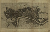
| A New and Complete Plan of London Westminster and Southwark with Additional Buildings to the Year 1777 | London, England | 1775 | var | Unknown | Coming Soon |
1 |  |
 |
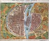
| Paris depuis Charles V jusqu’a Charles IX, d’après le plan de l’Abbaye St. Victor. | Paris, France | 1839 | var | Unknown | Coming Soon |
1 | |
 |
MAGIC also offers maps for the United States, Midwest, Northeast Atlantic, New England, Connecticut, and Connecticut Towns within the United States.