Title |
Location |
Year |
Scale |
Cartographer/
Source |
Metadata |
Series # |
Download Georeferenced TIFF
|
View & Download Map |
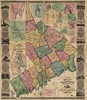
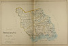
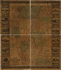
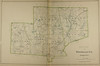
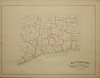
| Map of the state of Connecticut showing Indian trails, villages and sachemdoms. |
Connecticut |
1625 (1930) |
s350 |
Griswold |
|
1 |
 |
 |
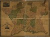
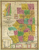
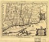
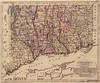
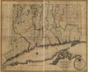
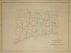
| A map of the colonies of Connecticut and Rhode Island, divided into counties & townships, from the best authorities. |
Connecticut |
1758 |
s1000 |
Kitchin |
|
1 |
|
 |
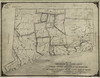
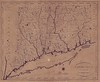
| To the right honourable, the Earl of Shelbourne, His Majesty's principal Secretary of State for the Southern Department. This plan of the colony of Connecticut in North-America. Is humbly dedicated by his lordships most obedient humble servt. Moses Park. Novr. 24, 1766. |
Connecticut |
1766 |
s275 |
Park |
|
1 |
|
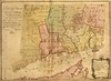 |
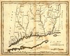
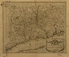
| A map of Connecticut and Rhode Island, with Long Island Sound, &c. |
Connecticut |
1776 |
s1100 |
unknown |
|
1 |
|
 |
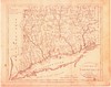
| Connecticut and parts adjacent. |
Connecticut |
1777 |
s500 |
Romans |
|
1 |
|
 |
| [Long Island Sound Shore from Fairfield to New London.] |
Connecticut |
1779 |
s126 |
Ferguson |
|
1 |
|
 |
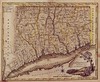
| A new and accurate map of Connecticut and Rhode Island from the best authorities. |
Connecticut |
1780 |
s00 |
unknown |
|
1 |
|
 |
| Connecticut and parts adjacent. |
Connecticut |
1780 |
s375 |
Covens |
|
1 |
|
 |
A new and correct map of Connecticut : one of the United States of North America from actual survey, humbly dedicated by permission to his excellency Samuel Huntington esquire Governor
and Commander in Chief of said state. |
Connecticut |
1792 |
s190 |
Blodget |
|
1 |
|
 |
| A Map of Connecticut. |
Connecticut |
1794 |
s00 |
unknown |
|
1 |
|
 |
| Connecticut, from the best authorities. |
Connecticut |
1795 |
s460 |
Doolittle |
|
1 |
|
 |
| Connecticut. |
Connecticut |
1796 |
s380 |
Sotzmann |
|
1 |
|
 |
| Connecticut, from the best authorities. |
Connecticut |
1796 |
s400 |
Tanner |
|
1 |
|
 |
| A correct map of Connecticut from actual survey. |
Connecticut |
1797 |
s300 |
Doolittle |
|
1 |
|
 |
| A new map of Connecticut from the best authorities. |
Connecticut |
1799 |
s760 |
Anderson |
|
1 |
|
 |
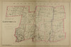
| Connecticut, from actual survey. |
Connecticut |
1811 |
s163 |
Warren |
|
1 |
|
 |
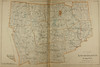
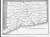
| Connecticut. |
Connecticut |
1824 |
s600 |
Finley |
|
1 |
|
 |
| Connecticut. |
Connecticut |
1850 |
s00 |
Mitchell |
|
1 |
|
 |
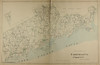
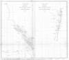
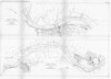
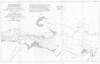
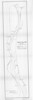
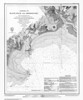
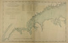
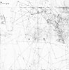
| Sketch B no. 2, showing the triangulation and geographical positions in section no. II from New York City to Point Judith. |
Connecticut |
1850 |
s350 |
USCS |
|
1 |
|
 |
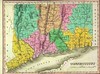
| Colton's Connecticut: with portions of New York and Rhode Island. |
Connecticut |
1855 |
s00 |
Colton |
|
1 |
|
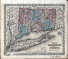 |
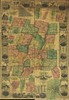
| Clark & Tackaburys' new topographical map of the state of Connecticut |
Connecticut |
1859 |
s90 |
Clark |
Coming Soon |
1 |
|
 |
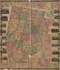
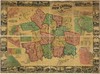
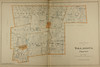
| Connecticut Drawn Expressly for the Atlas of the State of Connecticut from the Town and city atlas of the State of Connecticut. |
Connecticut |
1893 |
s00 |
Hurd |
Coming Soon |
12-13 |
|
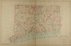 |
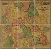
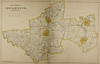
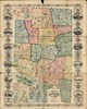
| Map of Connecticut showing Counties, Senatorial Districts, and Towns from the Town and city atlas of the State of Connecticut. |
Connecticut |
1893 |
s00 |
Hurd |
Coming Soon |
16 |
|
 |
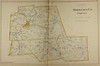
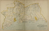
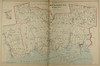
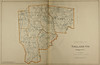
| Map of Connecticut showing Towns, Counties and Congressional Districts from the Town and city atlas of the State of Connecticut. |
Connecticut |
1893 |
s00 |
Hurd |
Coming Soon |
17 |
|
 |
| Connecticut. |
Connecticut |
1930 |
s00 |
unknown |
|
1 |
|
 |
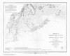
| DeVersche Rivier unt Groodt. |
Connecticut River |
1650 |
s00 |
unknown |
|
1 |
|
 |
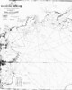
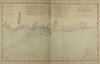
| Mouth of Connecticut River. |
Connecticut River |
1853 |
s20 |
USCS |
|
1 |
|
 |
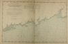
| Sketch B no. 3, showing the progress of the survey of Connecticut River; Sketch B no. 4, showing the progress of the resurvey of the coast of New Jersey. |
Connecticut River |
1862 |
s200 |
USCS |
|
1 |
|
 |
| Plates to accompany report upon Surveys of the Connecticut River between Hartford and Holyoke, 1871 to 1875. |
Connecticut River |
1878 |
s10 |
USACE |
|
|
|
 |
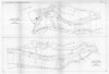
| Plates to accompany report upon Surveys of the Connecticut River between Hartford and Holyoke, 1871 to 1875. |
Connecticut River |
1878 |
s10 |
USACE |
|
|
|
 |
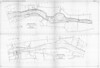
| Plates to accompany report upon Surveys of the Connecticut River between Hartford and Holyoke, 1871 to 1875. |
Connecticut River |
1878 |
s10 |
USACE |
|
|
|
 |
| Plates to accompany report upon Surveys of the Connecticut River between Hartford and Holyoke, 1871 to 1875. |
Connecticut River |
1878 |
s10 |
USACE |
|
|
|
 |
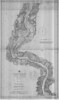
| Connecticut River, Conn. : from Hartford to Rocky Hill, June 30, 1883. |
Connecticut River |
1883 |
s12 |
USACE |
|
1 |
|
 |
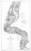
| Connecticut River : Rocky Hill to Hartford, Connecticut. |
Connecticut River |
1895 |
s20 |
USCS |
|
1 |
|
 |
| Connecticut River : Higganum to Rocky Hill, Connecticut. |
Connecticut River |
1896 |
s20 |
USCS |
|
1 |
|
 |
| Connecticut River : Higganum to Rocky Hill, Connecticut. |
Connecticut River |
1900 |
s20 |
USCS |
|
1 |
|
 |
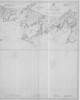
| Pawcatuck River and Little Narragansett Bay, R.I. and Conn. in 3 sheets. |
Pawtucket River |
1875 |
s17 |
USACE |
|
1 |
|
 |
| Pawcatuck River and Little Narragansett Bay, R.I. and Conn. in 3 sheets. |
Pawtucket River |
1875 |
s17 |
USACE |
|
2 |
|
 |
| Pawcatuck River and Little Narragansett Bay, R.I. and Conn. in 3 sheets. |
Pawtucket River |
1875 |
s17 |
USACE |
|
3 |
|
 |
| Thames River, Conn. : from Norwich to Indian Point. |
Thames River |
1878 |
s10 |
USACE |
|
1 |
|
 |
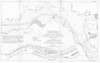
| North Shore Long Island Sound Bridgeport Bar and Harbor, Conn. From Entrance to Bridgeport. |
Bridgeport Harbor Entrance to Bridgeport |
1835 |
s05 |
USCS |
|
1 |
|
 |
| North Shore Part of L.I. Sound from Sheffield Lt. to Oak Neck, Conn-N.Y. |
Sheffield Lt. to Oak Neck, CT-NY |
1836 |
s10 |
USCS |
|
1 |
|
 |
| North Shore Part of L.I. Sound from Sheffield Lt. to Oak Neck, Conn-N.Y. |
Sheffield Lt. to Oak Neck, CT-NY |
1836 |
s10 |
USCS |
|
2 |
|
 |
| North Shore Part of L.I. Sound from Sheffield Lt. to Oak Neck, Conn-N.Y. |
Sheffield Lt. to Oak Neck, CT-NY |
1836 |
s10 |
USCS |
|
3 |
|
 |
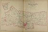
| Harbors of Black Rock and Bridgeport. |
Black Rock and Bridgeport Harbors |
1848 |
s00 |
USCS |
|
1 |
|
 |
| Harbors of Captain's Island East and Captain's Island West : (Harbors of refuge no.). |
Captain's Is. East and Captain's Is. West |
1849 |
s00 |
USCS |
|
1 |
|
 |
| Long Island Sound from Little Captain I. to Barker Point, Conn. |
Little Captain Is. to Barker Point, CT |
1837 |
s10 |
USCS |
|
1 |
|
 |
| Long Island Sound from Little Captain I. to Barker Point, Conn. |
Little Captain Is. to Baker Point, CT |
1837 |
s10 |
USCS |
|
2 |
|
 |
| New York and Norwalk Islands. Long Island Sound from the Town and city atlas of the State of Connecticut. |
New York to Norwalk Islands, CT |
1893 |
s00 |
Hurd |
Coming Soon |
20-21 |
|
 |
| Norwalk Islands to Southwest Ledge. Long Island Sound from the Town and city atlas of the State of Connecticut. |
Norwalk Islands to Southwest Ledge, CT |
1893 |
s00 |
Hurd |
Coming Soon |
24-25 |
|
 |
| Southwest Ledge to Niantic Bay. Long Island Sound from the Town and city atlas of the State of Connecticut. |
Southwest Ledge to Niantic Bay, CT |
1893 |
s00 |
Hurd |
Coming Soon |
28-29 |
|
 |
| Niantic Bay to RockyPoint. Long Island Sound from the Town and city atlas of the State of Connecticut. |
Niantic Bay to Rocky Point, CT |
1893 |
s00 |
Hurd |
Coming Soon |
32-33 |
|
 |
| North shore of Long Island Sound, Stamford Harbor to Little Captain Island, Connecticut. |
Stamford Harbor to Little Captain Is. |
1896 |
s10 |
USCS |
|
1 |
|
 |
| North Shore Long Island Sound Sheffield Lt. to Great Captain Island, Conn. |
Sheffield Lt. to Great Captains Is. |
1836 |
s10 |
USCS |
|
1 |
|
 |
| North Shore Long Island Sound Sheffield Lt. to Great Captains Island, Conn. |
Sheffield Lt. to Great Captain Is. |
1836 |
s10 |
USCS |
|
2 |
|
 |
| Entrances to the Norwalk and Saugatuck Rivers and the Norwalk Islands, Connecticut. |
Ent. to Norwalk and Saugatuck Rivers and Norwalk Islands |
1888 |
s10 |
USCS |
|
1 |
|
 |
| North shore of Long Island Sound, Sheffield Island to Westcott Cove, Connecticut. |
Sheffield Is. to Westcott Cove |
1896 |
s10 |
USCS |
|
1 |
|
 |
| North Shore [of] Long Island Sound from Black Rock Lt. to Sheffield Lt., Conn. |
Black Rock Lt. to Sheffield Lt. |
1835 |
s10 |
USCS |
|
1 |
|
 |
| North Shore [of] Long Island Sound from Black Rock Lt. to Sheffield Lt., Conn. |
Black Rock Lt. to Sheffield Lt. |
1835 |
s10 |
USCS |
|
2 |
|
 |
| North Shore [of] Long Island Sound from Black Rock Lt. to Sheffield Lt., Conn. |
Black Rock Lt. to Sheffield Lt. |
1835 |
s10 |
USCS |
|
3 |
|
 |
| North Shore [of] Long Island Sound from Black Rock Lt. to Sheffield Lt., Conn. |
Black Rock to Sheffield Lt. |
1835 |
s10 |
USCS |
|
4 |
|
 |
| North shore of Long Island Sound, George's Rock to Sheffield Island, including Saugatuck and Norwalk Rivers, Connecticut. |
George's Rock to Sheffield Is. |
1896 |
s10 |
USCS |
|
1 |
|
 |
| New Haven Harbor, Connecticut. |
New Haven Harbor |
1896 |
s10 |
USCS |
|
2 |
|
 |
| Long Island Sound from Charles Island to Black Rock Lt., Conn. |
Charles Is. to Black Rock Lt. |
1837 |
s10 |
USCS |
|
1 |
|
 |
| Long Island Sound from Charles Island to Black Rock Lt., Conn. |
Charles Is. to Black Rock Lt. |
1837 |
s10 |
USCS |
|
2 |
|
 |
| Long Island Sound from Charles Pt. to New Haven Harbor, Conn. |
Charles Pt. to New Haven Harbor |
1838 |
s10 |
USCS |
|
1 |
|
 |
| North shore of Long Island Sound, Fairfield to George's Rock, Connecticut. |
Fairfield to George's Rock |
1895 |
s10 |
USCS |
|
1 |
|
 |
| North Shore Long Island Sound From Little Harbor to Mansfield Pt., Conn. |
Little Harbor to Mansfield Pt. |
1838 |
s10 |
USCS |
|
1 |
|
 |
| North Shore Part of Long Island Sound from Hammonasset Beach to Hoadley Pt., Conn. |
Hammonasset Beach to Hoadley Pt. |
1838 |
s10 |
USCS |
|
1 |
|
 |
| North Shore Part of Long Island Sound from Hammonasset Beach to Hoadley Pt., Conn. |
Hammonassett Beach to Hoadley Pt. |
1838 |
s10 |
USCS |
|
2 |
|
 |
| Long Island Sound Connecticut River Entrance to Westbrook Harbor, Conn. |
Connecticut R. to Westbrook Harbor |
1838 |
s10 |
USCS |
|
1 |
|
 |
| Long Island Sound, Connecticut River Entrance to Westbrook Harbor, Conn. |
Connecticut R. to Westbrook Harbor |
1838 |
s10 |
USCS |
|
2 |
|
 |
| Long Island Sound : North Shore... from Mumford's Cove to Black Point, Conn. |
Mumford's Cove to Black Pt. |
1839 |
s10 |
USCS |
|
1 |
|
 |
| Long Island Sound : North Shore... from Mumford's Cove to Black Point, Conn. |
Mumford's Cove to Black Pt. |
1839 |
s10 |
USCS |
|
2 |
|
 |
| Long Island Sound : North Shore... from Mumford's Cove to Black Point, Conn. |
Mumford's Cove to Black Pt. |
1839 |
s10 |
USCS |
|
3 |
|
 |
| Long Island Sound : North Shore... from Mumford's Cove to Black Point, Conn. |
Mumford's Cove to Black Pt. |
1839 |
s10 |
USCS |
|
4 |
|
 |
| Long Island Sound From Fishers Island to Oysters Pond Point, Conn. and New York. |
Fisher's Island to Oysters Pond Pt. (CT/NY) |
1839 |
s10 |
USCS |
|
5 |
|
 |
| Long Island Sound From Fishers Island to Oysters Pond Point, Conn. and New York. |
Fisher's Island to Oysters Pond Pt. (CT/NY) |
1839 |
s10 |
USCS |
|
6 |
|
 |
| Fishers Island Sound and Pawcatuck River, Long Island Sound. Conn, Rhode Island, New York. |
Fishers Is. Sound to Pawcatuck R. |
1839 |
s20 |
USCS |
|
1 |
|
 |
| Fishers Island Sound and Pawcatuck River, Long Island Sound. Conn, Rhode Island, New York. |
Fishers Is. Sound to Pawcatuck |
1839 |
s20 |
USCS |
|
2 |
|
 |
| Long Island Sound from Stafford Point to Jeffery's Point, Conn. |
Stafford Pt. to Jeffery's Pt. |
1839 |
s20 |
USCS |
|
1 |
|
 |
| Long Island Sound from Stafford Point to Jeffery's Point, Conn. |
Stafford Pt. to Jeffery's Pt. |
1839 |
s20 |
USCS |
|
2 |
|
 |
| North Shore Long Island Sound from Hammonasset Pt. to Johnson's Pt., Conn. |
Hammonasset Pt. to Johnson's Pt. |
1839 |
s20 |
USCS |
|
1 |
|
 |