IFLA Section of Geography and Map Libraries
If you have any suggestions, comments or items that you would like to see added to this collection, please direct your messages to: libmap1@uconnvm.uconn.edu
IFLA Section of Geography and Map Libraries |
|
|
|
Title |
Digital Map Librarianship: Working with Geodata: Downloading from the WWW |
Downloading from the WWW |
There is a growing amount of digital geodata avialable on the WorldWide Web. The data are in vector, raster and attribute formats. |
Vector Data |
The source of comprehensive world vector data is the Digital Chart
of the World. The DCW is a set of data in the global public domain. The
data available from the Pennsylvania State University (PSU) server has
been pre-processed by ESRI, inc. While the copyright of the data is retained
by ESRI, they have agreed to make it available for public use  in
cooperation with PSU and IFLA. "ESRI's
intent is to provide useful, free Internet client software to help fulfill
the ESRI vision of widespread, readily available GIS data exploration tools,
contributing to the creation of a true "societal" GIS."
There are other sources for data, but the DCW includes the entire world
at a scale of 1:1,000,000. The primary source for this database is the
US Defense Mapping Agency (DMA) Operational Navigation Chart (ONC) series
that are produced by the United States, Australia, Canada, and the United
Kingdom. The ONCs have a scale of 1:1,000,000 (1 inch equals approximately
16 miles). A guide to the PSU server will help you navigate your spatial information needs. in
cooperation with PSU and IFLA. "ESRI's
intent is to provide useful, free Internet client software to help fulfill
the ESRI vision of widespread, readily available GIS data exploration tools,
contributing to the creation of a true "societal" GIS."
There are other sources for data, but the DCW includes the entire world
at a scale of 1:1,000,000. The primary source for this database is the
US Defense Mapping Agency (DMA) Operational Navigation Chart (ONC) series
that are produced by the United States, Australia, Canada, and the United
Kingdom. The ONCs have a scale of 1:1,000,000 (1 inch equals approximately
16 miles). A guide to the PSU server will help you navigate your spatial information needs.
|
Raster Data |
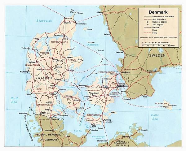
A collection of country maps is available from the University of Texas'
Perry-Castañeda
Library Map Collection.  These
maps have been scanned from a collection of maps done by various agencies
of the United States federal government. The data are in the public domain.
By downloading an image, the user is able to load the image into a GIS
program such as MapInfo, by registering the Latitude/Longitude and projection
(usually Lambert Conformal). With the image as geodata, the user can overlay
data or digitize vectors off of the image. These
maps have been scanned from a collection of maps done by various agencies
of the United States federal government. The data are in the public domain.
By downloading an image, the user is able to load the image into a GIS
program such as MapInfo, by registering the Latitude/Longitude and projection
(usually Lambert Conformal). With the image as geodata, the user can overlay
data or digitize vectors off of the image.
|
Collections |
There are some institutions, not libraries, which have been charged to make available geodata, sometimes in the public domain. This list is not comprehensive. |
Internet Nexae |
There are a number of nexae of geodata that websters have pulled together.
Here are a few select:
These sites each have a different flavor and focus. |
Clearinghouses |
In the past five years the notion of a "clearinghouse" of spatial information has gained favor. The U.S. National Spatial Data Infrastructure (NSDI) encompasses policies, standards, and procedures for organizations to cooperatively produce and share geographic data. Search the Clearinghouse. |
Suggested Citation |
McGlamery, Patrick, "Digital Map Librarianship: Working with geodata; Hands-on, Downloading from the WWW, Other geodata." Digital Map Librarianship: a working syllabus, 63rd IFLA Conference, Copenhagen, Denmark. (4, Sept. 1997; updated 9, Aug. 1999) <http://magic.lib.uconn.edu/ifla/wg_ho_www.htm> |
|
Patrick McGlamery Map Librarian Map and Geographic Information Center University of Connecticut Libraries Storrs, CT 06268 libmap1@uconnvm.uconn.edu |