IFLA Section of Geography and Map Libraries
If you have any suggestions, comments or items that you would like to see added to this collection, please direct your messages to: libmap1@uconnvm.uconn.edu
IFLA Section of Geography and Map Libraries |
|
|
|
Title |
Digital Map Librarianship: Building Digital Collections: Image GeoData | ||||
Image Geodata |
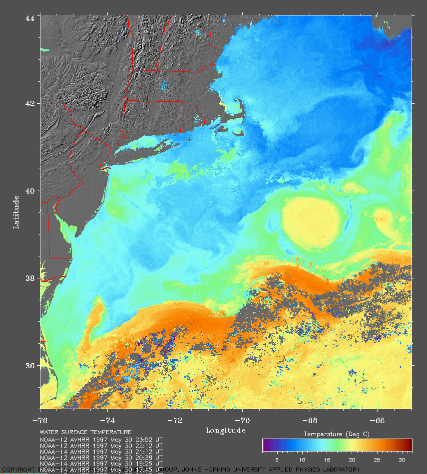
Image data can represent any number of types of information. Fundamentally,
images are raster datasets, usually considered a picture or graphic. These
data can range from scanned historical maps or aerial photographs to computer-sensed
satellite imagery. Even thermal and topographical data can be represented
as imagery.
Image data becomes image geodata when it is associated with spatial
information. Projection and coordiante unit and point must be supplied
to the raster file, either as metadata
or as a GeoTIFF.
The experimental site at the Massachusetts Institute of Technology's Dept.
of Urban Studies and Planning However, libraries with their extensive holdings, are the best providers of image data. Projects which scan existing library holdings are important contributions that libraries can make to the information community. These are simply a selection of noteworthy projects already underway:
| ||||
Examples |
| ||||
Suggested Citation |
McGlamery, Patrick, "Digital Map Librarianship: Library functions; Building Collections, Image data." Digital Map Librarianship: a working syllabus, 63rd IFLA Conference, Copenhagen, Denmark. (4, Sept. 1997; updated 9, Aug. 1999) <http://magic.lib.uconn.edu/ifla/lb_bc_im.htm> |
|
Patrick McGlamery Map Librarian Map and Geographic Information Center University of Connecticut Libraries Storrs, CT 06268 libmap1@uconnvm.uconn.edu |
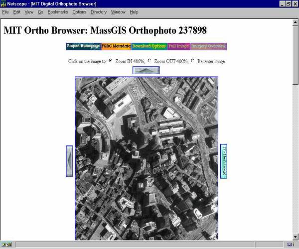 is
a good example of supplying the raster/image data with auxillary files
the enable spatial analysis. These digital orthophotographs of Boston can
be downloaded with header files which render the image files as geodata
raster files for MapInfo and ArcView.
is
a good example of supplying the raster/image data with auxillary files
the enable spatial analysis. These digital orthophotographs of Boston can
be downloaded with header files which render the image files as geodata
raster files for MapInfo and ArcView.